Difference between revisions of "Category:Forest Maps"
Jump to navigation
Jump to search
| Line 3: | Line 3: | ||
== Considerations == | == Considerations == | ||
When using the forest maps and tree heights, you must manually consider the accuracy of the dataset used. | When using the forest maps and tree heights, you must manually consider the accuracy of the dataset used. | ||
| − | You can do this by accessing recent orthophotos or satellite images (which could be the windPRO [http://help.emd.dk/mediawiki/index.php?title=WindPRO_European_Satellite_Imagery European Satellite Imagery] or the [http://help.emd.dk/mediawiki/index.php?title=WindPRO_Global_Satellite_Imagery Global Satellite Imagery]). | + | You can do this by accessing and inspecting recent orthophotos or satellite images (which could be the windPRO [http://help.emd.dk/mediawiki/index.php?title=WindPRO_European_Satellite_Imagery European Satellite Imagery] or the [http://help.emd.dk/mediawiki/index.php?title=WindPRO_Global_Satellite_Imagery Global Satellite Imagery]). |
Revision as of 14:34, 28 June 2018

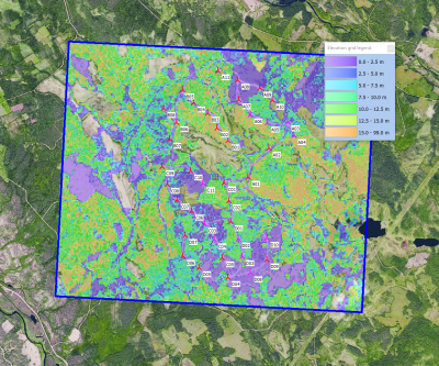
The forest maps are used in the forest models in WindPRO - and used for energy yield calculations in forested terrain. Model data is used in the displacement height calculator and the Objective Roughness Approach (ORA). Data is stored from the ‘elevation grid object’ with data-type set to ‘Heights above terrain (a.g.l) for elements’.
Considerations
When using the forest maps and tree heights, you must manually consider the accuracy of the dataset used. You can do this by accessing and inspecting recent orthophotos or satellite images (which could be the windPRO European Satellite Imagery or the Global Satellite Imagery).
Pages in category "Forest Maps"
The following 10 pages are in this category, out of 10 total.