Difference between revisions of "European EMODnet Bathymetry"
Jump to navigation
Jump to search
| Line 43: | Line 43: | ||
== Acknowledgement == | == Acknowledgement == | ||
| − | The European Marine Observation and Data Network (EMODnet) is thanked for producing this digital elevation dataset – and disseminating it in the public domain and thus for aiding the development of renewable energy. | + | * The European Marine Observation and Data Network (EMODnet) is thanked for producing this digital elevation dataset – and disseminating it in the public domain and thus for aiding the development of renewable energy. |
| + | * Integration of the 2018 dataset into EMD services - was co-supported through the InnoWind project (www.innowind.dk) - which is co-funded by the Danish Innovation Fund | ||
== External Links == | == External Links == | ||
* Description of the EMODnet Bathymetry data set: http://www.emodnet-bathymetry.eu/data-products | * Description of the EMODnet Bathymetry data set: http://www.emodnet-bathymetry.eu/data-products | ||
Revision as of 12:55, 17 June 2019
Introduction
For windPRO users working with offshore wind farm development, the "EMODnet Digital Bathymetry (DTM)" is a multilayer bathymetric product for Europe’s sea basins containing water depths. Two versions version exists:
- 2016: The 2016-version is based upon more than 7700 bathymetric survey data sets and composite DTMs that have been gathered from 27 data providers from 18 European countries. The 2016-DTM has a grid resolution of 1/8 * 1/8 arc minutes (roughly 230 * 230 meters).
- 2018: An updated version was released in 2018 with more data - now 9400 surveys from 49 data-providers - and with a higher resolution - now at 1/16 arc-minute (approximately 115 meters). The vertical reference level for the 2018-data in windPRO is the mean-sea-level (MSL).
Availability from within WindPRO and Usage Notes
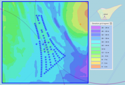
The data is available directly from within windPRO and can be accessed from the online-services in the Elevation Grid Object.
Usage:
- In order to access the data, please set the purpose of the Elevation Grid Object to 'Water depths'.
- If you want to export the grid to contour lines: This can be done from within the grid-object, simply select the layer of interest, then choose 'Export Layer'.
- Selected areas within the domain has higher resolution data available: These may be downloaed directly fromt he EMODnet portal.
Reference System
The following reference system was used in the original data:
- Geo [deg,min] - WGS84
Coverage
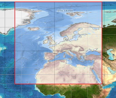
- The Greater North Sea, including the Kattegat and stretches of water such as Fair Isle, Cromarty, Forth, Forties, Dover, Wight, and Portland
- The English Channel and Celtic Seas
- Western and Central Mediterranean Sea and Ionian Sea
- Bay of Biscay, Iberian coast and North-East Atlantic
- Adriatic Sea
- Aegean - Levantine Sea (Eastern Mediterranean)
- Azores - Madeira EEZ
- Canary Islands
- Baltic Sea
- Black Sea
- Norwegian – Icelandic seas
License and Attribution
Please use the following attribution when using this dataset - and also consider and accept the disclaimer from EMODnet.
EMODnet Bathymetry Consortium (2018). EMODnet Digital Bathymetry (DTM 2018). Distribution through windPRO and EMD.
https://doi.org/10.12770/18ff0d48-b203-4a65-94a9-5fd8b0ec35f6

EMODnet Bathymetry Consortium (2016): EMODnet Digital Bathymetry (DTM 2016). Distribution through windPRO and EMD.
http://doi.org/10.12770/c7b53704-999d-4721-b1a3-04ec60c87238.
Acknowledgement
- The European Marine Observation and Data Network (EMODnet) is thanked for producing this digital elevation dataset – and disseminating it in the public domain and thus for aiding the development of renewable energy.
- Integration of the 2018 dataset into EMD services - was co-supported through the InnoWind project (www.innowind.dk) - which is co-funded by the Danish Innovation Fund
External Links
- Description of the EMODnet Bathymetry data set: http://www.emodnet-bathymetry.eu/data-products

