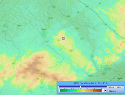
UK-Northern Ireland - OSNI-Open-Data
(Redirected from OSNI-Open-Data)
Jump to navigation
Jump to search
The printable version is no longer supported and may have rendering errors. Please update your browser bookmarks and please use the default browser print function instead.
Introduction
OSNI Open Data is a digital elevation dataset for Northern Ireland with a grid resolution of 10m.
Dataset Overview
- Spatial Coverage: UK - Northern Ireland
- Resolution: 10 m
- Data-type: Digital Terrain Model (DTM)
- Coordinate system: Irish (in original data)
- Version: Data downloaded in 2018
- Vertical Accuracy:
- The DTM is created from stereo-imagery
- Vertical reference: Meters above mean sea level at Belfast Lough
- Accuracy is stated to be 1.0m RMSE
Availability in WindPRO
The data is available from the WindPRO online services. The data can be accessed from the online-services in the following objects:
- Elevation Grid Object
- Line Object
Licence and Acknowledgement
OSNI Open Data products are free to download, use and share subject to the "Open Government Licence" which is available here: http://osni-spatial-ni.opendata.arcgis.com/
External Links
- Original data is available from the web-page of the Ordnance Survey Northern Ireland http://osni-spatial-ni.opendata.arcgis.com/
- More on the 10m Digital Terrain Model at nidirect - https://www.nidirect.gov.uk/articles/10m-digital-terrain-model-height-data
