ÜSTÜN windPROSPER maps
Introduction
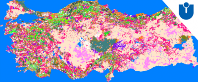
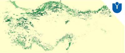
During years 2016-2018, EMD International A/S formed a project partnership with the Technical University of Denmark and ÜSTÜN Energy Engineering LLC from Turkey within the Eurostars project “windPROSPER”. In early 2019 final products have started to be implemented into windPRO, with first EMD releasing the ERA5-based EMD-WRF Europe+ mesoscale wind map. The “ÜSTÜN windPROSPER Maps” is another of the outputs of the project and it delivers high quality, up-to-date roughness and tree height maps of Turkey and Denmark. Now, it is possible to get access to the ÜSTÜN windPROSPER maps directly from the online-services of windPRO. These commercial data are licenced directly from ÜSTÜN Energy Engineering with a yearly subscription. Planned maintenence of the dataset is scheduled at a one or two years cycle. In windPRO, the following ÜSTÜN windPROSPER maps are available for Turkey and Denmark:
- Roughness maps
- Tree height maps
The roughness and tree height maps were derived from satellite images and local digitized maps through a detailed study encompassing both urban and vegetated areas. With the ÜSTÜN windPROSPER maps, you can have the most realistic, up-to-date roughness map of Turkey and Denmark ready to use in your windPRO application and modules. For Turkey, the tree height database includes the 47 most common tree types of Turkey as well as the non-vegetated areas. Read more at ÜSTÜN Energy Engineering here.
Data Applicability and Availability within windPRO
Forest Height Data:
The forest height data are used as input for the dedicated sub-models in windPRO which takes into account the forest impact on the wind flow. This is the displacement height calculator and the Objective Roughness Approach (ORA) tool. Both forest models are available from windPRO 3.2+. The forest data is accessed from the online-services from the ‘elevation grid object’ with data-type set to ‘Heights above terrain (a.g.l) for elements’.
Roughness Data:
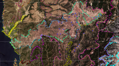
Access to the roughness data is via the windPRO 'area object' or the 'line object'.
Sources, Coverage and Resolution
ÜSTÜN windPROSPER maps currently covers the following domains:
- Turkey
- Denmark
All datasets come with a 100m grid resolution.
Forest map is based on 2017-2018 data.
Data Sources: Danish Maps
ÜSTÜN WindPROSPER Danish maps are produced during the development of WindPROSPER project by means of the country-wise terrain lidar scans provided by the "Styrelsen for Dataforsyning og Effektivisering, Energi-, Forsynings- og Klimaministeriet" office under the distribution name of "DHM/Overflade-02 / sdfe.dk" where the 0.4m resolution lidar scan data are provided with LAZ format. The aerodynamic roughness of the cities, open fields (h<1.3m) and tall vegetation areas (h>1.3m) are separately calculated and combined with other spatial averaging methods using the CLC 2012 polygons and grouped by a high number of roughness classes for Denmark. The dataset set is validated against local measurements, see more at the ÜSTÜN web-site below.
Data Sources: Turkish Maps
ÜSTÜN WindPROSPER Turkish maps are produced during the development of WindPROSPER project by means of local tree allometry, local city regulations and combination of CORINE Land Cover dataset 2012 (maintained by the European Environment Agency (EEA)). The aerodynamic roughness of the cities, open fields (h<1.3m) and tall vegetation areas (h>1.3m) are separately calculated and combined under the spatial averaging methodology by used of the CLC 2012 polygons and grouped with a high number of roughness classes for Turkey. The dataset set is validated against local measurements, see more at the ÜSTÜN web-site below.
Validation
The current model developed and validated by ÜSTÜN Energy Engineering LLC has also been published in scientific publications. The applied forest model is published in an SCI-Expanded indexed journal in open access format. (https://onlinelibrary.wiley.com/doi/10.1002/ese3.496)
Contact and License
In order to get access to the data - all you need to do for registration is to contact ÜSTÜN Energy Engineering in Turkey www.USTUNEnerji.com and fill out a short form with your company information and windPRO license number. In a few days time, your maps will be available directly in windPRO when accessing the windPRO online-services.
Links
- ÜSTÜN Energy Engineering - WindPROSPER maps: http://ustunenerji.com/en/maps/
- EMD-WRF Europe+ - WindPROSPER mesoscale wind map and time-series data at this wiki
- WindPROSPER at Eurostars
- EMD's participation in WindPROSPER was co-funded by Innovation Fund Denmark - https://innovationsfonden.dk


