Difference between revisions of "Copernicus DEM"
m |
m (→License) |
||
| Line 41: | Line 41: | ||
The 30m and 90m Copernicus DEM datasets are available as free datasets for the general public under the terms and conditions of the License found here as [https://help.emd.dk/mediawiki/images/f/f4/20210615_CSCDA_ESA_Mission-specific_Annex.pdf pdf]. Please consult this License document for details on usage conditions and be aware to provide one of the following notifications when communicating to the general public or distributing the data: | The 30m and 90m Copernicus DEM datasets are available as free datasets for the general public under the terms and conditions of the License found here as [https://help.emd.dk/mediawiki/images/f/f4/20210615_CSCDA_ESA_Mission-specific_Annex.pdf pdf]. Please consult this License document for details on usage conditions and be aware to provide one of the following notifications when communicating to the general public or distributing the data: | ||
| − | |||
<pre> | <pre> | ||
| − | Copernicus DEM GLO-90 - unmodified data: | + | Copernicus DEM GLO-90 (Copernicus WorldDEM™-90) or Copernicus DEM GLO-30 (Copernicus WorldDEM™-30) - unmodified data: |
- © DLR e.V. 2010-2014 and © Airbus Defence and Space GmbH 2014-2018 provided under COPERNICUS by the European Union and ESA; | - © DLR e.V. 2010-2014 and © Airbus Defence and Space GmbH 2014-2018 provided under COPERNICUS by the European Union and ESA; | ||
all rights reserved. | all rights reserved. | ||
| − | Copernicus DEM GLO-90 - adapted or modified data: | + | Copernicus DEM GLO-90 (Copernicus WorldDEM™-90) - adapted or modified data: |
- Produced using Copernicus WorldDEM™-90 © DLR e.V. 2010-2014 and © Airbus Defence and Space GmbH 2014-2018 provided under COPERNICUS by the European Union and ESA; | - Produced using Copernicus WorldDEM™-90 © DLR e.V. 2010-2014 and © Airbus Defence and Space GmbH 2014-2018 provided under COPERNICUS by the European Union and ESA; | ||
all rights reserved. | all rights reserved. | ||
| + | |||
| + | Copernicus DEM GLO-30 (Copernicus WorldDEM™-30) - adapted or modified data: | ||
| + | - Produced using Copernicus WorldDEM-30 © DLR e.V. 2010-2014 and © Airbus Defence and Space GmbH 2014-2018 provided under COPERNICUS by the European Union and ESA; | ||
| + | all rights reserved”. | ||
</pre> | </pre> | ||
Revision as of 23:47, 15 June 2021
Notification: CopernicusDEM is currently being integrated into windPRO 3.4 and 3.5.
Introduction
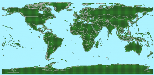
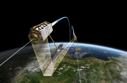
The Copernicus Digital Elevation Models (DEM) - or short Copernicus DEMs - is a set of DEM's with global coverage released from the European Space Agency (ESA). Two versions (or instances) of this dataset are available to the general public: a global model at 90m resolution (Copernicus DEM GLO-90) and a near-global model at 30m resolution (Copernicus DEM GLO-30). The Copernicus DEM is a digital surface model (DSM) so it includes all surface structures - like buildings, infrastructure and forests. The Copernicus DEM is derived from an edited DSM named WorldDEM(TM) with the WorldDEM model being based on radar satellite data from the TanDEM-X mission. The WorldDEM model has been infilled on a local basis with other DEMs, such as ASTER, SRTM90, SRTM30, SRTM30plus, GMTED2010, TerraSAR-X Radargrammetric DEM and ALOS World 3D-30m.
Dataset Overview
- Spatial Coverage:
- Copernicus DEM GLO-30: Global (however, see usage notes below)
- Copernicus DEM GLO-90: Global
- Resolution: 30m (1-arc-second) and 90m (3-arc-second) grid resolution.
- Data-type: Digital Surface Model (DSM)
- Coordinate system
- Horizontal: Geographic WGS (EPSG:4326)
- Vertical: Earth Gravitational Model - EGM2008 geoid (EPSG: 3855)
- Version:
- Data accessed and prepared for use in windPRO during June 2021.
- The data acquisition period for the WorldDEM(TM) mission is is 2010-2015.
- Vertical Accuracy (according to product manual):
- Absolute vertical accuracy: Less than 4m (90% linear error)
- Relative vertical accuracy: Less than 2m for slope <20%. Less than 4m for slope >20%.
- Absolute horizontal accuracy: <6m (90% circular error)
- No data value: -32767 (in original data)
Usage Notes
- The spatial resolution of the raw Copernicus DEM is fixed in meters (30m or 90m), but the raw data-tiles are still stored with geographical coordinates. As such, the resolution in longitude-direction is varying with latitude. For the data in windPRO, all Copernicus DEM data has been resampled into a fixed resolution in decimal degrees using a bi-linear interpolation algorithm. The 30m dataset is stored with a global 1-arc-second resolution and the 90m dataset as a global 3-arc-second resolution.
- For the windPRO 30m Copernicus dataset, the missing (non-released) tiles have been patched with data from the 90m datase. These tiles have been resampled to the 30m grid resolution. A list of the affected tiles in Armenia and Azerbaijan is available here.
Availability from within windPRO
The DSM-data is available directly from within windPRO. The DSM elevation data is delivered as gridded data with a spatial resolution of 1 or 3 arc second. As a part of the processing of the DSM elevation data from our EMD server, the user has an option of choosing whether the data downloaded should be received as either raw gridded data or converted to height contour lines. In order to use the data for energy yield calculations, the data must be converted to contours. These data be accessed from the online-services in the following two objects:
- DSM-Data in the line object (with purpose to height contour lines)
- DSM-Data in the elevation grid object
Acknowledgement
- The European Commission, the European Space Agency and the Copernicus team are acknowledged for the development and release of the free and open Copernicus data.
- Credit: © DLR e.V.(2014-2018) and © Airbus Defence and Space GmbH (2021) provided under COPERNICUS by the European Union and ESA; all rights reserved.
- We acknowledges the importance of releasing the Copernicus DEM's into the public domain and its contribution to improve modelling of the renewable energy sources - and wind energy in particular.
License
The 30m and 90m Copernicus DEM datasets are available as free datasets for the general public under the terms and conditions of the License found here as pdf. Please consult this License document for details on usage conditions and be aware to provide one of the following notifications when communicating to the general public or distributing the data:
Copernicus DEM GLO-90 (Copernicus WorldDEM™-90) or Copernicus DEM GLO-30 (Copernicus WorldDEM™-30) - unmodified data:
   - © DLR e.V. 2010-2014 and © Airbus Defence and Space GmbH 2014-2018 provided under COPERNICUS by the European Union and ESA;
     all rights reserved.

Copernicus DEM GLO-90 (Copernicus WorldDEM™-90) - adapted or modified data:
   - Produced using Copernicus WorldDEM™-90 © DLR e.V. 2010-2014 and © Airbus Defence and Space GmbH 2014-2018 provided under COPERNICUS by the European Union and ESA;
     all rights reserved.

Copernicus DEM GLO-30 (Copernicus WorldDEM™-30) - adapted or modified data:
   - Produced using Copernicus WorldDEM-30 © DLR e.V. 2010-2014 and © Airbus Defence and Space GmbH 2014-2018 provided under COPERNICUS by the European Union and ESA;
     all rights reserved”.

