Corine Land Cover
Introduction
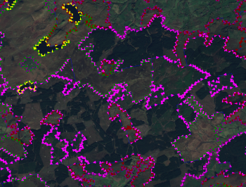
Corine land cover products (2006 and 2012) are produced by visual interpretation of high resolution satellite imagery. It consists of an inventory of land cover in 44 classes which has been mapped in to roughness lengths for use in WindPRO. It is produced and delivered by the European Environment Agency (EEA). http://www.eea.europa.eu/
Coverage
This dataset covers most parts of Europe. It has a spatial resolution of 100 m.
Legends
The Corine 2006 and 2012 datasets has 44 different categories that EMD has mapped in to a suggested roughness length, z0.
| ID | Land Cover Type | EMD Roughness Length |
|---|---|---|
| 1 | Continuous urban fabric 1.1.1 | z0=0.50000 |
| 2 | Discontinuous urban fabric 1.1.2 | z0=0.40000 |
| 3 | Industrial or commercial units 1.2.1 | z0=0.70000 |
| 4 | Road and rail networks and associated land 1.2.2 | z0=0.10000 |
| 5 | Port areas 1.2.3 | z0=0.50000 |
| 6 | Airports 1.2.6 | z0=0.03000 |
| 7 | Mineral extraction sites 1.3.1 | z0=0.10000 |
| 8 | Dump sites 1.3.2 | z0=0.10000 |
| 9 | Construction sites 1.3.3 | z0=0.30000 |
| 10 | Green urban areas 1.4.1 | z0=0.40000 |
| 11 | Sport and leisure facilities 1.4.2 | z0=0.50000 |
| 12 | Non-irrigated arable land 2.1.1 | z0=0.05600 |
| 13 | Permanently irrigated land 2.1.2 | z0=0.05600 |
| 14 | Rice fields 2.1.3 | z0=0.01840 |
| 15 | Vineyards 2.2.1 | z0=0.30000 |
| 16 | Fruit trees and berry plantations 2.2.2 | z0=0.40000 |
| 17 | Olive groves 2.2.3 | z0=0.40000 |
| 18 | Pastures 2.3.1 | z0=0.03600 |
| 19 | Annual crops associated with permanent crops 2.4.1 | z0=0.05600 |
| 20 | Complex cultivation patterns 2.4.2 | z0=0.05600 |
| 21 | Land principally occupied by agriculture, with significant areas of natural vegetation 2.4.3 | z0=0.05600 |
| 22 | Agro-forestry areas 2.4.4 | z0=0.50000 |
| 23 | Broad-leaved forest 3.1.1 | z0=0.50000 |
| 24 | Coniferous forest 3.1.2 | z0=0.50000 |
| 25 | Mixed forest 3.1.3 | z0=0.50000 |
| 26 | Natural grassland 3.2.1 | z0=0.05600 |
| 27 | Moors and heathland 3.2.2 | z0=0.06000 |
| 28 | Sclerophyllous vegetation 3.2.3 | z0=0.05600 |
| 29 | Sparse coniferous forest, cc. 10-30% 3.2.4 | z0=0.40000 |
| 30 | Beaches, dunes, and sand plains 3.3.1 | z0=0.01000 |
| 31 | Bare rock 3.3.2 | z0=0.05000 |
| 32 | Sparsely vegetated areas 3.3.3 | z0=0.20000 |
| 33 | Burnt areas 3.3.4 | z0=0.20000 |
| 34 | Glaciers and perpetual snow 3.3.5 | z0=0.20000 |
| 35 | Inland marshes 4.1.1 | z0=0.05000 |
| 36 | Peat bogs 4.1.2 | z0=0.01840 |
| 37 | Salt marshes 4.2.1 | z0=0.03480 |
| 38 | Salines 4.2.2 | z0=0.03000 |
| 39 | Intertidal flats 4.2.3 | z0=0.00050 |
| 40 | River 5.1.1 | z0=0.00000 |
| 41 | Lake 5.1.2 | z0=0.00000 |
| 42 | Coastal lagoons 5.2.1 | z0=0.00000 |
| 43 | Estuaries 5.2.2 | z0=0.00000 |
| 44 | Sea and ocean 5.2.3 | z0=0.00000 |
| 45 | NO DATA | z0=-1.00000 |
Rights
EEA standard re-use policy: unless otherwise indicated, re-use of content on the EEA website for commercial or non-commercial purposes is permitted free of charge, provided that the source is acknowledged (http://www.eea.europa.eu/legal/copyright).
Copyright holder: European Environment Agency (EEA).
