Difference between revisions of "Shuttle Radar Topography Mission"
| Line 3: | Line 3: | ||
== Coverage == | == Coverage == | ||
| − | About 80% of the total landmass of the Earth is mapped by the STRM data, covering all land between 56 degrees south and 60 degrees northern latitude. A view of the data coverage is shown in | + | About 80% of the total landmass of the Earth is mapped by the STRM data, covering all land between 56 degrees south and 60 degrees northern latitude. A view of the data coverage is shown in the figure below. |
| + | [[File:SRTMCoverage.jpg|left|400px|thumb|Near-global coverage of the SRTM dataset]] | ||
== Data Type == | == Data Type == | ||
Revision as of 10:00, 23 May 2013
Shuttle Radar Topography Mission (SRTM)
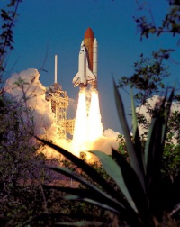
The Shuttle Radar Topography Mission (SRTM) data originate from an 11 day mission flown by the space shuttle Endeavour back in February, 2000, on its mission STS-99. The raw data was collected using an instrument named “Spaceborne Imaging Radar-C”. The raw data was later processed and released as usable digital grid files.
Coverage
About 80% of the total landmass of the Earth is mapped by the STRM data, covering all land between 56 degrees south and 60 degrees northern latitude. A view of the data coverage is shown in the figure below.
Data Type
The SRTM data are delivered as gridded data with a spatial resolution of the dataset corresponding to 3 arc seconds, i.e. approximately 90 m distance between grid points. As a part of the processing of the SRTM data from our EMD server, the user has an option of choosing whether the data downloaded should be received as either raw gridded data or converted to height contour lines. In order to use the data for energy yield calculations, the data must be converted to contours.
Data Sources
Different versions of the SRTM data exist; at EMD we currently distribute the STRM data version 3.The difference between various versions is primarily that more error checking and validation is applied at later versions.
An alternative SRTM dataset with a higher spatial resolution of 1 arc second (about 30 m) is also available for the US and its territories. Currently this dataset is currently not available through the EMD online services, but it is possible to manually download the data and load the data into a line object.
