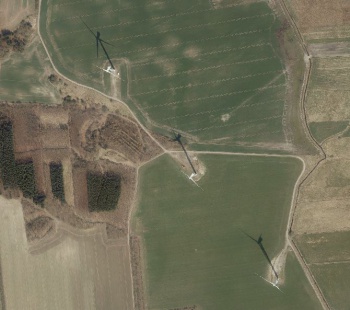
Danish Orthophoto Mosaic
Introduction
The Danish Orthophoto Mosaic is a part of the dynamic, zoomable maps in windPRO. The orthophotos were released by the Danish Geodata Agency (Geodatastyrelsen). Update frequency for Danish orthophotos is every year, with current data in windPRO from 2018. Pixel size for the dynamic map in windPRO is 0.50m. If you want to even higher resolution data – but as a static map – the 0.125m data is available as a WMS service in windPRO.
Usage Notes
- The mosaic was created from available data sources accessed in March 2019
- The most recent imagery is used to create the mosaic
- High resolution (12.5 cm / pixel) is available as a WMS service in windPRO.
Availability from within windPRO
- From map window: Click the ‘Add map’ globe-icon -> then ‘Dynamic Maps’.
- From main menu: Click ‘Project’ -> ‘Properties’ -> ‘Background Maps’ -> ‘Dynamic Maps’
- To access higher-resolution WMS-service: Click ‘Project’ -> ‘Properties’ -> ‘Background Maps’ -> ‘Import from WMS server’ -> 'KMS - Ortofoto forår'
License and Attribution
Contains data from the Danish Geodata Agency, Danish Springtime Orthophotos, 2019
Acknowledgement
- The Danish Geodata Agency are thanked for producing this digital dataset – and disseminating it in the public domain and thus for aiding the development of renewable energy.
- Integration of this dataset into EMD services - was co-supported through the InnoWind project (www.innowind.dk) - which is co-funded by the Danish Innovation Fund
