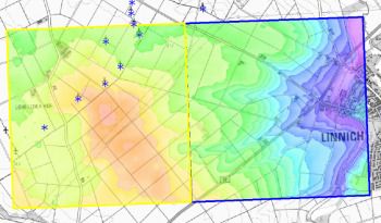
German NRW Elevation Model
Introduction
The Nordrhein-Westfalen elevation model is a digital terrain model (Digitales Geländemodell) produced from data originally obtained from Geobasis NRW. The derived elevation model delivered with windPRO is at 5m resolution. The original model, named DGM1, is at 1m resolution. However, the windPRO version is resampled by EMD to obtain a slightly coarser resolution - 5m - in order for the data to be operational for the larger areas needed in the context of wind farm analysis’. The laser-scans in the DTM1 model were obtained with a sampling rate of 1-4 points per square meters. A continuous LIDAR measurement campaign is being made, with the whole of the state being completed at a 6-year cycle.
Vertical accuracy in the 1m resolution dataset is stated to be ±0.2m, however will be larger in areas with forest, industry, at settlements or steep-slopes
Availability from within WindPRO
The data are available directly from within windPRO in 5-meter grid resolution. The data can be accessed from the online-services in the following objects:
- Line Object (with purpose to height contour lines)
- Elevation Grid Object
Reference System
The following reference system were used in the original data:
- ETRS89/UTM32 (EPSG 25832)
- Vertical: DHHN2016 (EPSG 7837)
License and Attribution
The product belongs to the open geo-data of Nordrhein-Westfalen. The data have been licensed under a Data license Germany – attribution – version 2.0 (Datenlizenz Deutschland - Namensnennung - Version 2.0) -"dl-de/by-2-0".
Please accept the license conditions and use a proper attribution when using this dataset, such as: Contains modified elevation data from Geobasis NRW (geobasis.nrw.de). Adapted and distributed by EMD and windPRO. “dl-de/by-2-0".
The product belongs to the open data of the National Land Survey of Finland. Open data by the National Land Survey of Finland is licensed under a Creative Commons Attribution 4.0 International License.
Acknowledgement
- The Geobasis NRW are thanked for producing this digital elevation dataset – and disseminating it in the public domain and thus for aiding the development of renewable energy.
- Integration of this dataset into EMD services - was co-supported through the InnoWind project (www.innowind.dk) - which is co-funded by the Danish Innovation Fund
External Links
Site with description of the elevation model (in German language): www.geobasis.nrw.de InnoWind project: http://www.innowind.dk
