Global AW3D30
Introduction
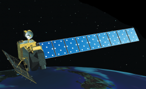
The “ALOS World 3D 30 m mesh (AW3D30)" dataset is recent digital surface model (DSM) with global coverage. The version 2.1 of the dataset was released in early 2018 – and it holds a global coverage in a 30m (1-arc-second) resolution. The dataset was created with the aim for a target vertical accuracy of 5m RMSE – and a horizontal accuracy of 5m. AW3D30 was generated from data obtained from the Panchromatic Remote-sensing Instrument for Stereo Mapping (PRISM) - an instrument that was carried onboard the Japanese Advanced Land Observing Satellite (ALOS). The ALOS satellite was launched on January 24th 2006; it had an expected target life of 5 years. After a successful mission it ended its operations during May 2011 due to a power anomaly. This dataset was produced by JAXA - Japan's Aerospace Exploration Agency.
Dataset Overview
- Spatial Coverage: Global - coverage is most of land bodies on earth
- Reolution: 1 arc-second (30m)
- Data-type: Digital Surface Model (DSM)
- Coordinate system: Geographic WGS (EPSG:4326)
- Version: WindPRO holds the 2.1 version of the AW3D30 data
Recommendations
The AW3D30 dataset is very interesting for wind-resource application due to its acurracy and resolution. However, since the dataset was obtained using optical sensors, then many of the satellite images used in the DEM-creation could be covered with clouds or have low contrast – such as ice and snow. Such areas are problematic for an optical-stereorography approach. If such problematic errors exists in the imagery, then these cloud or snow/iceareas have been void filled with data from alternative sources – using a data from SRTM3, DEM10 data in Japan or PRISM DSM. As such, the EMD recommendation is currently to use the AW3D30 dataset as a supplement to other sources such as SRTM1 or other global/regional datasets - and to validate if any void-fills have been caried out in your model domain.
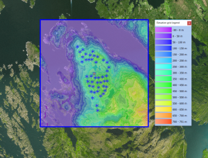
The AW3D30 quality mask is available from within the windPRO area object, and we recommend that you inspect it (look for void-filled areas) in the following way:
- Open your windPRO project and create a new area-object
- Set purpose to '3d Animation and Photomontage'
- Go to the - 'Import/Export' tab - and press the 'online-data' button
- Choose the 'AW3D30 Elevation Model - Quality Mask' - and press 'OK' to load the data
- Go-to the 'presentation' tab - and set checkmark in 'Transparent' for the 'Boundary Line' - then press 'OK'
- Right-click the area-object icon - remove the 'edit-mode' and choose to 'show legend'
Accuracy of AW3D30
Digital elevation models are evaluated using ground control points (GCP’s). For the AW3D30, several evaluations exists: A preliminary study by (Tadono et al., 2016) showed that the AW3D30 dataset has a vertical accuracy of 4.40m (RMSE) and a bias of -0.44m – considering 5121 independent ground control points (GCP’s) with global distribution. The same study reported that SRTM v. 3 had a RMSE of 7.50m and a -1.00m bias at the same locations.
Availability from within windPRO
The DSM-data and the associated quality mask are available directly from within windPRO. The DSM elevation data is delivered as gridded data with a spatial resolution of 1 arc second. As a part of the processing of the DSM elevation data from our EMD server, the user has an option of choosing whether the data downloaded should be received as either raw gridded data or converted to height contour lines. In order to use the data for energy yield calculations, the data must be converted to contours. These data be accessed from the online-services in the following three objects:
- DSM-Data in the line object (with purpose to height contour lines)
- DSM-Data in the elevation grid object
- Quality mask from AW3D30 is accessed from the area-object
Acknowledgement, Credits and License
Acknowledgement: JAXA is acknowledged for the development and release of this free dataset - and thus for aiding the development of renewable energy and wind energy in particular.
Copyright: The Alos World 3D 30m data is provided by JAXA which also holds copyright of the data.
License: When using the AW3D30 data, you are bound by the JAXA licensing conditions, which makes the dataset available and ready-to-use with no charge under the following conditions:
- When you provide or publish any products and services to a third party using this dataset, you are kindly requested to display that the original data is provided by JAXA.
- When you publish the product(s) using this dataset, you are kindly requested to show the copyright (©JAXA) and the source of data.
- JAXA does not guarantee the quality and reliability of this dataset and JAXA assume no responsibility whatsoever for any direct or indirect damage and loss caused by use of this dataset. Also, JAXA will not be responsible for any damages of users due to changing, deleting or terminating the provision of this dataset. We (EMD) recommend the following statement to comply with the JAXA conditions:
Contains AW3D30 elevation data from the JAXA (Japan Autonomous Region of Sardinia 01/2019. Data processing and distribution through EMD and windPRO. CC-BY-40 sardegnageoportale.it.
External Links
- More information on ALOS DSM project is available at http://www.eorc.jaxa.jp/ALOS/en/about/about_index.htm
- AW3D30 - Product description from JAXA (pdf-format) - here
- A commercial, higher resolution version of the AW3D30 dataset is available from NTT-data and Restec - see https://www.aw3d.jp/en/

