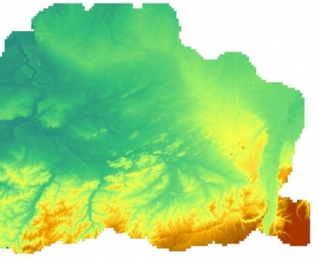
Iceland Elevation Model
Revision as of 12:24, 24 May 2022 by Ronnie (talk | contribs) (Created page with "Category: Online DataCategory: Digital Elevation ModelsCategory: InnoWind Image:BEL.jpg|right|thumb|350px|Part of the 1m DTM for Flanders, Belgium. Credit: Conta...")
Introduction
Iceland LMI Elevation Model 2016 - 10m resolution (LMÍ Hæðarlíkan 2016): The National Land Survey of Iceland has released a DTM of Iceland: This new DTM is an upgrade of an earlier DTM. The recent data added, which vary in origin, cover 39.100 km2 or some 38% of the country.
Dataset Overview
- Spatial Coverage: Iceland
- Reesolution: 10m
- Data type: Digital Terrain Model (DTM)
- Coordinate system: ISN93 / Lambert (EPSG:3057)
- Version: 2016
- Vertical accuracy: Varies, see image to the right and usage notes below
Usage Notes
- An alternativetive Icelandic elevation model (IcelandDEM version 1.0) is available from the icelandic
- The vertical accuracy of the new (2016) data added are (see location on figure to the right): 1) Lidar data for the glaciers of Iceland (surveyed in the years 2007-2012), 15144 km2, LE90: 2.65 m. 2) Data from 5-m-contour lines, 10736 km2, LE90: 3.9 m. 3) Emisar radar data, 4536 km2, LE90: 3.2 m. 4) Data from 10-m-contour lines, 2938 km2, LE90: 8.48 m, 5) SwedeSurvey photogrammetic data, 1433 km2, LE90: 2.60 m, 6) 1:25.000 contour data, 1152 km2, LE90: 3.8 m, 7) British lidar data (courtesy of Dr. Susan Conway, Open University), 532 km2, LE90: 0.96-4.63 m.
Availability from within WindPRO
The data are available directly from within windPRO in 10-meter resolution. The data can be accessed from the online-services in the following objects:
- Line Object (with purpose to height contour lines)
- Elevation Grid Object
Acknowledgement
- The LMI are thanked for producing this digital elevation dataset – and disseminating it in the public domain and thus for aiding the development of renewable energy - and wind energy in particular.
License
The product belongs to the open geo-data of Iceland - and it was released from the National Land Survey of Iceland according to the Creative Commons Attribution 4.0 International License. An attribution must be made when using data, such as:
- Contains data from the Iceland LMI Elevation Model 2016 from the National Land Survey of Iceland (LMI)
- Distribution through EMD and windPRO. CC BY 4.0.
External Links
- [1] The National Land Survey of Iceland]
