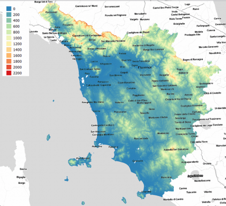
Italy-Tuscany Elevation Model
Introduction
The Italy-Tuscany 10m elevation model is a digital terrain model produced by the Tuscany Region through its Direzione Generale Governo del Territorio. The elevation data are in a 10m x 10m grid and have a spatial coverage for the whole of Tuscany. The model was produced from base maps in scale 1:10000 in years 1993-1998.
Dataset Overview
- Spatial Coverage: Tuscany Region, Italy
- Resolution: 10 m
- Data-type: Digital Terrain Model (DTM)
- Coordinate system: Gauss-Boaga Fuso Ovest (EPSG:3003) in original data
- Version: Data downloaded in January 2019.
- Vertical Accuracy: N/A
Usage Notes
Higher resolution data exists for selected areas in the region based on more recent LiDAR surveys:
These 1m and 2 m gridded data may be accessed directly from the geodata-portal of Tuscany:
http://www502.regione.toscana.it/geoscopio/cartoteca.html
Availability from within windPRO
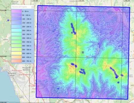
The data are available directly from within windPRO in 10-meter resolution. The data can be accessed from the online-services in the following objects:
- Line Object (with purpose to height contour lines)
- Elevation Grid Object
License and Attribution
The product belongs to the open data of the region of Tuscany. The data are license under a under a Creative Commons Attribution 4.0 International License. Please use the following attribution when using this dataset:
Source: Contains elevation data from the Region of Tuscany 05/2019. Licence: CC-BY-40.
Distribution through EMD and windPRO.
Acknowledgements
- The Region of Tuscany and its Direzione Generale Governo del Territorio are thanked for producing this digital elevation dataset – and disseminating it in the public domain and thus for aiding the development of renewable energy.
- Integration of this dataset into EMD services was co-supported through the InnoWind project ([http://www.innowind.dk www.innowind.dk) which is co-funded by the Danish Innovation Fund
External Links
- Geodata from the Tuscany Geoportal: http://www502.regione.toscana.it/geoscopio/cartoteca.html
- InnoWind project - http://www.innowind.dk

