Difference between revisions of "WindPRO Global Satellite Imagery"
m (→Usage Notes) |
|||
| Line 26: | Line 26: | ||
[[Image:SpectralBands_Sentinel2andLandsat7.png|right|thumb|400px|Spectral bands of Sentinel 2 compared to Landsat 7/8 (Credit: NASA)]] | [[Image:SpectralBands_Sentinel2andLandsat7.png|right|thumb|400px|Spectral bands of Sentinel 2 compared to Landsat 7/8 (Credit: NASA)]] | ||
In these two datasets, it is possible that some inconsistencies and issues exists. This may be caused by: | In these two datasets, it is possible that some inconsistencies and issues exists. This may be caused by: | ||
| − | # No data coverage (or poor image quality) - this is | + | # No data coverage (or poor image quality) - this is mainly for the 2018 release dataset |
# Various levels of cloud cover - as a cloud-free image might not exist | # Various levels of cloud cover - as a cloud-free image might not exist | ||
# Very dark or light parts of the image - brightness adjustment are being made at a large size tile level | # Very dark or light parts of the image - brightness adjustment are being made at a large size tile level | ||
Revision as of 16:15, 3 August 2022
Introduction
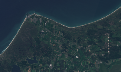
With the release of the "windPRO Global Satellite Imagery - 10m" dataset in 2018, users of windPRO 3.2+ obtained free access to high-resolution, reliable and updated satellite imagery from anywhere in the world. The color images of terrain, vegetation and urban areas can be a valuable aid when undertaking roughness classification studies or when you need fully updated maps for a particular area. The dataset was updated in 2022 with more recent and more cloud-free data, so now two versions of this map-dataset exists named after the release year in windPRO:
- windPRO Global Satellite Imagery - 10m (2018):
Release year: 2018 - holds data from 2016-2017 - with images a mosaic - windPRO Global Satellite Imagery - 10m (2022):
Release year: 2022 - holds data from 2017-2018 - with images as a composite
Dataset Description
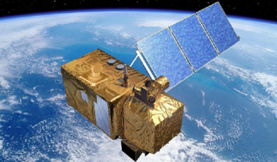
The two polar orbiting Sentinel-2 satellites are a part of the Copernicus Earth Observation system – a large multi-billion euro EU infrastructure project. The 2A-satellite was launched in June 2015 and the 2B in March 2017. Both satellites deliver high-resolution multi-spectral images (in 12 spectral bands) – and have a revisit time of 5 days over any part of the world (but the time of the visit may, of course, coincide with cloudy conditions). Resolution of the satellite imagery is dependent on spectral band and ranging from 10 m to 60 m. The different spectral bands can be combined to provide images with specific purposes, e.g. true-color (RGB-images), highlighting urban areas or vegetation.
- windPRO Global Satellite Imagery - 10m (2018)
Our "windPRO Global Satellite Imagery - 10m (2018)" holds a global coverage and a (nearly) cloud free dataset. It is based on Sentinel-2 satellite imagery obtained during years 2016-2017. The data was processed by EMD in late 2017 and was made accessible from our windPRO 3.2 release in early 2018. Please note, that global coverage is obtained by an image mosaic, so you will might see a few areas without data coverage and tiles with various levels of cloud cover. Also, some tiles may seem dark or bright - as no brightness adjustment has been made. A more recent and higher quality dataset is made available in 2022: "windPRO Global Satellite Imagery - 10m (2022)".
- windPRO Global Satellite Imagery - 10m (2022)
The "windPRO Global Satellite Imagery - 10m (2022)" is a global coverage and almost cloud free satellite imagery dataset at a high (10m) resolution. Source data for this dataset is based on Sentinel-2 Level 1C imagery from the years 2017-2018. The windPRO imagery is post-processed (derived) as a natural color RGB composite from the excellent Global Human Settlement composite (GHS-composite-S2 R2020A). The GHS composite is processed and released from Joint Research Centre (JRC) at the European Commission.
Access, Resolution and Coverage
- Access: From within the 'Dynamic Maps' section in the windPRO background map area. You will need a windPRO version 3.2+ and and active service agreement to access the data.
- Resolution: The maximum spatial resolution is 10 m per pixel.
- Period:
- 2018 dataset: Most data is from the period 2016 and 2017.
- 2022 dataset: Most data is from the period 2016 and 2017.
- Coverage: The "WindPRO Global Satellite Imagery" dataset covers most of the globe, however some ocean areas may be missing.
Usage Notes
In these two datasets, it is possible that some inconsistencies and issues exists. This may be caused by:
- No data coverage (or poor image quality) - this is mainly for the 2018 release dataset
- Various levels of cloud cover - as a cloud-free image might not exist
- Very dark or light parts of the image - brightness adjustment are being made at a large size tile level
License and Acknowledgement
- The European Commission and the European Space Agency are acknowledged for the development and release of the free and open Sentinel-2 data.
- Development and Integration of this dataset into EMD services was co-supported through the InnoWind project ([http://www.innowind.dk www.innowind.dk) which is co-funded by the Danish Innovation Fund
Attribution
Proper attribution for this data-set would be: "WindPRO Global Satellite Imagery - 10m by EMD International A/S (Contains modified Copernicus Sentinel data 2016 & 2017)".
External Links
Innowind Project: http://www.innowind.dk/
Copernicus Data: http://copernicus.eu/


