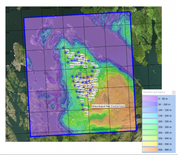
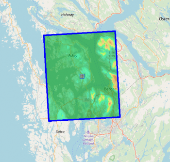
Norwegian Elevation Models

Data source:
"DTM10/DOM10" by Kartverket is licensed under CC BY 4.0.

Data source:
"DTM10/DOM10" by Kartverket is licensed under CC BY 4.0.
Introduction
The national elevation models for Norway (DTM and DOM) are created by the Norwegian national ordnance survey (Kartverket). These data-sets in windPRO come at a 10 meter grid resolution. They are generated primarily based based on laser scans - and are continuously updated. The versions distributed in windPRO by EMD were downloaded during late August 2018. Currently, we distribute the digital terrain model (DTM10) and the digital surface model (DOM10)
Dataset Overview
- Spatial Coverage: Mainland Norway - see here
- Resolution: 10 m
- Data-type:
- DTM10: Digital Terrain Model (DTM)
- DOM10: Digital Surface Model (DSM)
- Coordinate system:
- Horizontal: : For maximum spatial accuracy, we deliver the data in 3 UTM-zones. Coordinate systems used: ETRS 89 UTM Zone 32/33/35 (EPSG:25832, EPSG:25833, EPSG:25835)
- Vertical:: Vertical reference system is NN2000 (EPSG:5941). This system used the same basis as the new European vertical system (Normaal Amsterdams Peil, EVRF2007).
- Version: Data downloaded in August 2018.
- Vertical Accuracy: N/A
Availability from within WindPRO
The data are available directly from within windPRO in 10 meter resolution. As a part of the processing of the DTM10/DOM10 elevation data from our EMD server, the user has an option of choosing whether the data downloaded should be received as either raw gridded data or converted to height contour lines. In order to use the data for energy yield calculations, the data must be converted to contours. The data can be accessed from the online-services in the following objects:
- Line Object (with purpose set to height contour lines)
- Elevation Grid Object (with data-type set to 'Elevation data')
- Elevation Grid Object (with data-type set to 'Surface data')
Experiences and Usage Notes
- A windPRO user has reported a location where the DTM10/DOM10 have missing data (seen as a hole in the data). This has been confirmed by EMD - and it is originating from the original source of data. If you experience simmilar issues - we encurage to see if newer data is abailable from the excellent data-portal for Norwegian elevation data: https://hoydedata.no. WindPRO will easily read geotiff files from that page - just load the data into an elevation grid object in windPRO.
Licence and Acknowledgement
The data are distributed according to the terms of use for open and free geographical data in Norway. The license is Creative Commons by Attribution 4.0. As stated in these license conditions, please take proper care to add an attribution in order to acknowledge the source of information and any changes done to the data. This could be done by adding the following statement to your report-picture or map:
Data source: "DTM10/DOM10" by Kartverket is licensed under CC BY 4.0.
Distribution through EMD and windPRO.
The following parties are acknowledged:
- Kartverket is acknowledged for the development and release of this free and open dataset.
- Integration of this dataset into EMD services was co-supported through the InnoWind project ([http://www.innowind.dk www.innowind.dk) which is co-funded by the Danish Innovation Fund
External Links
- Coverage information and information about a preceeding dataset (DTM 10 Terrengmodell) may be found in this pdf-file].
- Access to the Norwegian data (also in higher resolution, down to 1m) - see https://hoydedata.no
- InnoWind project - see http://www.innowind.dk