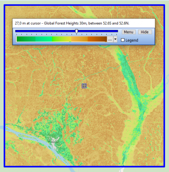
Near-Global Forest Canopy Heights GLAD
Introduction
The Near Global Forest Canopy Height (GLAD, 2019) is a dataset developed from a fusion of GEDI lidar data (Global Ecosystem Dynamics Investigation Lidar) and Landsat imagery data.
This dataset has a near global spatial coverage ranging from latitudes 52.6S to 52.6N.
Currently (2020) it is to be considered as a prototype map as both machine learning algorithms and available data are still being being improved.
The dataset was developed by the Global Land Analysis and Discovery (GLAD) laboratory in the Department of Geographical Sciences at the University of Maryland.
The data reflects the 95% relative height of the canopy. In the current version, tree heights beyond 30m are saturated by the model used.
Usage Notes
- Point 1
- Point 2
Availability from within WindPRO
The forest height data is available directly from within windPRO in 30 meter resolution. The data can be accessed from the online-services in the 'Elevation Grid Object' in the following way.
- Open the 'Elevation Grid Object'.
- Select ‘Data type’ to ‘Heights above terrain (a.g.l) for “elements”.
- Click ‘Add Layer from Online Data‘.
Data Type and Use in windPRO
Coverage
This dataset covers the world, between .
License
Acknowledgement
- Point
- Point
External Links
- Link
- Link
