Norwegian SR16 Forest Heights

Introduction
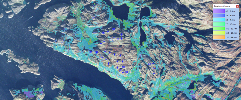
The Norwegian Institute of Bioeconomy Research (NIBIO) is developing a national forest resource map (Skogressourskart, SR16). Currently - summer 2019 - coverage is still being expanded - with the goal to get full national coverage. At this time a total of 152 of 422 municipalicies have been relased as a part of the dataset. The map is generated through automated processing of existing maps, terrain models, 3d-remote-sensing and field-data measurements. The Norwegian forest heights in windPRO comes with a 16m grid resolution. This dataset will be updated as new data become available from NIBIO.
Data Applicability and Availability within windPRO
The forest height data are used as input for the dedicated sub-models in windPRO which takes into account the forest impact on the wind flow. This is the displacement height calculator and the Objective Roughness Approach (ORA) tool. Both forest models are available from windPRO 3.2+.
The forest data is accessed from the online-services from the ‘elevation grid object’ with data-type set to ‘Heights above terrain (a.g.l) for elements’.
Technical Details (EMD processed data)
Dataformat: Raster / GeoTiff
Coordinate System: UTM - zone 32N - EUREF89 (EPSG: 25832)
Pixel values:
- Average canopy height in meters
- 32767 is a null value: the pixel does not belong to forestry land or canopy height is outside boundaries set (0.5m to 50m)
- For the data distributed in windPRO, the null values and missing data are neglected.
Spatial Resolution: 16m
Coverage: This dataset covers 152 of 432 municipalities - however more areas will be added in 2019. See the coverage in the figure to the top-right.
Releases:
- 2019.08: 152 of 432 municipalities are released with windPRO 3.3+

License and Attribution
This data-product belongs to the open data of the Norwegian Institute of Bioeconomy Research (NIBIO). The data have been licensed under the Norwegian License for Public Data (NLOD ver1.0). A requirement from this licens is that the source of information is acknowledged, so please accept the license conditions and use a proper attribution when using this dataset, such as:
Source:
Forest data from the Norwegian Institute of Bioeconomy Research (NIBIO).
Data processing and distribution through EMD and windPRO.
If you derive data from this dataset or are using it within a published product, then use the notification above (or a simmilar attribution).
A copy of the open-data license conditions can be found here in pdf-format or from this direct link.
Acknowledgements
- The Norwegian Institute of Bioeconomy Research and the pubic of Norway are thanked for producing this digital elevation dataset – and disseminating it in the public domain - and thus for aiding the development of renewable energy.
- Integration of this dataset into EMD services was co-supported through the InnoWind project ([http://www.innowind.dk www.innowind.dk) which is co-funded by the Danish Innovation Fund
External References
- Norwegian Institute of Bioeconomy Research (NIBIO): https://www.nibio.no/
- InnoWind project: http://www.innowind.dk