Web Map Service
Jump to navigation
Jump to search
The printable version is no longer supported and may have rendering errors. Please update your browser bookmarks and please use the default browser print function instead.
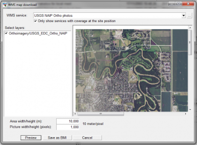
From WindPRO 2.9 it is now possible to add map-services from a WMS-server (Web Map Server).
A Web Map Service (WMS) is a standard protocol for serving georeferenced map images over the Internet. The maps are generated by a map server using data from a GIS database.
WMS Data Sources
You may add your own WMS servers in addition to the list provided by the EMD-server.
Below is a WMS-services list of samples from WindPRO. Note, that WindPRO will - by default - only show the datasets where data are available considering the location of your project. This (server-side generated list) may be updated at any time, so your windPRO instance may hold more or less WMS map services.
- Austrian DOP 8 m resolution from http://gis.lebensministerium.at
- Austrian topography in Salzburg state from http://service.salzburg.gv.at
- Austrian topography in Upper Austria state (1:50000) from http://ags.doris.at
- Austrian topography in Carinthia state (1:50000) from http://gis.ktn.gv.at
- Austrian streets and names in Lower Austria state from http://www.intermap1.noel.gv.at
- Austrian administrative boundaries in Tirol state from http://gis.tirol.gv.at/
- Czech topography from http://www.bnhelp.cz
- Danish maps (DTK) from http://kortforsyningen.kms.dk
- Danish orthophotos from http://kortforsyningen.kms.dk
- Danish raster topo-maps (in scales 1:25000, 1:50000 and 1:100000) from http://kortforsyningen.kms.dk
- Danish Cadastral Maps from http://kortforsyningen.kms.dk
- European maps from http://osm.wheregroup.com/
- German ATKIS maps from http://www.onmaps.de (requires license from onmaps)
- German topography 1:10000 and 1:50000 from http://www.wms.nrw.de
- Latvia maps from http://www.gisnet.lv
- Romanian maps from http://earth.unibuc.ro
- Switzerland topography 1:1000000 and more from http://wms.geo.admin.ch
- United States National Agriculture Imagery Program (NAIP) Orthophotos from http://raster.nationalmap.gov
- United States Naval Research Laboratory maps from http://geoint.nrlssc.navy.mil
