Global Land Cover Characteristics: Difference between revisions
Jump to navigation
Jump to search
| Line 1: | Line 1: | ||
== Introduction == | == Introduction == | ||
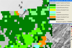
[[File: GLCCandWindPRO.png|right|thumb|250px|Global Land Cover Roughness Data]]Initially, the Global Land Cover Classification (GLCC) dataset was developed for land cover characterization in the range of environmental research and modelling applications. It is derived from the Advanced Very High Resolution Radiometer (AVHRR) data spanning a 12 month period from April 1992 to March 1993. The ACHHR is a space-borne sensor mounted on the National Oceanic and Atmospheric Administration (NOAA) family of polar orbiting platforms. | [[File: GLCCandWindPRO.png|right|thumb|250px|Global Land Cover Roughness Data]]Initially, the Global Land Cover Classification (GLCC) dataset was developed for land cover characterization in the range of environmental research and modelling applications. It is derived from the [http://en.wikipedia.org/wiki/Advanced_Very_High_Resolution_Radiometer Advanced Very High Resolution Radiometer (AVHRR)] data spanning a 12 month period from April 1992 to March 1993. The ACHHR is a space-borne sensor mounted on the National Oceanic and Atmospheric Administration (NOAA) family of polar orbiting platforms. | ||
== Coverage == | == Coverage == | ||
This dataset has a global coverage. It is based on a 1 km x 1 km grid, so note that such a resolution is to coarse for Micro scale AEP calculation models! This data is the version 2.0 of the global land cover characteristics data base, see the USGS web site [1]. | This dataset has a global coverage. It is based on a 1 km x 1 km grid, so note that such a resolution is to coarse for Micro scale AEP calculation models! This data is the version 2.0 of the global land cover characteristics data base, see the USGS web site [1]. | ||
Revision as of 16:31, 25 May 2013
Introduction

Initially, the Global Land Cover Classification (GLCC) dataset was developed for land cover characterization in the range of environmental research and modelling applications. It is derived from the Advanced Very High Resolution Radiometer (AVHRR) data spanning a 12 month period from April 1992 to March 1993. The ACHHR is a space-borne sensor mounted on the National Oceanic and Atmospheric Administration (NOAA) family of polar orbiting platforms.
Coverage
This dataset has a global coverage. It is based on a 1 km x 1 km grid, so note that such a resolution is to coarse for Micro scale AEP calculation models! This data is the version 2.0 of the global land cover characteristics data base, see the USGS web site [1].