WindSight - Premium Data Layers by DHI GRAS


Introduction
To use satellite-based data in the wind-energy flow modelling chains and to integrate those data into wind-energy yield assessments. That was one of the main goals of the InnoWind project that took place during years 2017-2020 and where EMD International A/S formed a project partnership with the Technical University of Denmark, DHI GRAS, Vestas and Vattenfall, see more at http://www.innowind.dk. The project was finalized in spring 2020 with a lot - that is about 50 - fast-track data-products derived from satellite and remote sensing missions being available directly in windPRO, see our dedicated InnoWind wiki page. Another important outcome from the project is the DHI GRAS WindSight data layers, read more here: http://windsight.dhigroup.com.
Get the latest news on geodata for wind-energy
If you want to follow which new datasets are being released with windPRO, please consider to sign up for the EMD-newsletter; or to follow EMD at our linked-in account. We are posting notifications on those channels whenever new datasets are released.
Tutorials: Presentation and Demonstration - Slides and Video
Presentations from the final InnoWind project workshop at March 20th 2020 are available from the links below: These media provide an excellent overview for a year 2020-status on how-to improve wind flow modelling using remote sensing data with special emphasis on wind energy within forested areas. Due to technical problems, the video recordings for the first part of the workshop are not available. Missing is the introduction by Merete Badger and the first part of the presentation by Torsten Bondo.
- InnoWind Workshop, Wind energy modelling in forest using newe satellite sensors. By Merete Badger (DTU) - pdf
- Satellite data information for improving wind resource estimation. By Torsten Bondo (DHI GRAS) - pdf - video
- How accurate are satellite derived tree heights? By Ebba Delwik (DTU) - pdf - video
- New forest data in mesoscale models. By Mark Zagar et al (Vestas) - pdf - video
- Improving the estimation of roughness length and displacement height for wind resource modelling using satellite data. By Rogier Floors (DTU) - pdf - video
- InnoWind Data Layers in windPRO. By Morten Lybech Thøgersen (EMD) - pdf - video
- Evaluation roughness maps at Østerild. By Rogier Floors (DTU) - video
WindSight - Premium Demonstration Data Layers
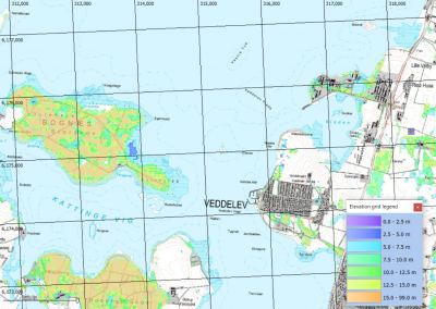
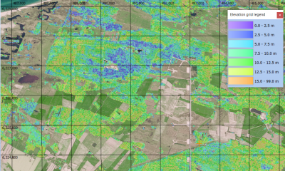
As a part of the InnoWind-project, DHI GRAS has developed its WindSight Premium Data Service. This service allows DHI GRAS to deliver data-layers of forest-height, land-cover and leaf-area-index in 20m resolution – based on Sentinel 1 and Sentinel 2 source data - with data layers being derived using machine-learning algorithms. These data are easily read with windPRO 3.4 – as they are typically delivered in geotiff-format. DHI GRAS also offers bathymetry data; feel free to visit their bathymetry portal for more information: https://bathymetrics.shop/#/mappage/.
Point of contact for DHI GRAS WindSight data:
WindPRO and WAsP users that is interested in the WindSight products may contact Torsten Bondo (tbon@dhigroup.com) from DHI GRAS for further details and pricing, see also www.dhi-gras.com. Read more about the WindSight data layers here: http://windsight.dhigroup.com/.
Data Samples and windPRO legends
6 packages of (an early) premium data sample are available for download for WAsP and windPRO users: These are for different parts of the world, while the two Danish ones are for the area around the DTU Risø campus and the other from the Danish National Test Station at Østerild. The 3 data layers of land-cover, LAI and canopy height are packed into a zip-file and available below.
- Denmark, Risø - available here
- Denmark, Østerild - here
- Portugal, Perdigao - here
- Mexico, Chihuahua - here
- South Africa, Humansdorp here
- Sweden, Ryningsnæs - here
Note: While it is possible to load these data into windPRO versions 3.3 and earlier versions - we recommend using windPRO 3.4 (64-bit version) to load the data. This version holds improvements to read geo-tiff files into the line-object and area-objects of windPRO. Legends to use with these files are available here as a zip file. To use these legends, please unpack the content to your folder with the windPRO 'standards'. Typically, this will be within this folder:
c:\WindPRO Data\3.4\Standards
Cheat Sheet: Use WindSight Premium Data in windPRO
These data layers are typically used with the forest models in windPRO, i.e. the displacement height calculator and the ORA tool. We have a created a small cheat-sheet that describes how these new data-layers are loaded into the respective objects in windPRO - and how they are 'consumed' in the different calculations. If you are using roughness files (as geotiff), we recommend to divide any 'floating point' values into a set of fixed categories (eg. with step of 0.25 in roughness class).
- WindSight and InnoWind data in windPRO - cheat sheet - here (pdf-format)
Please note that the cheat-sheet is also useful for understanding how raster-based data can be 'consumed' in a variety of ways in the different objects in windPRO - and how the data layers are consumed within the various calculations.
External Links
InnoWind was a joint R&D project with 5 participants - and co-funded by the Danish Innovation Fund:
- EMD International A/S (and the windPRO team)
- DTU Wind Energy & DTU Space
- DHI-GRAS
- Vestas
- Vattenfall
Get more information about the WindSight and bathymetry data layers at DHI GRAS:
- WindSight: http://windsight.dhigroup.com/
- Bathymetry: https://bathymetrics.shop/#/mappage/