Uploads by Morten
Jump to navigation
Jump to search
This special page shows all uploaded files.
| Date | Name | Thumbnail | Size | Description | Versions |
|---|---|---|---|---|---|
| 23:17, 30 May 2022 | TaiwanOpenDataLicense.pdf (file) | 80 KB | 1 | ||
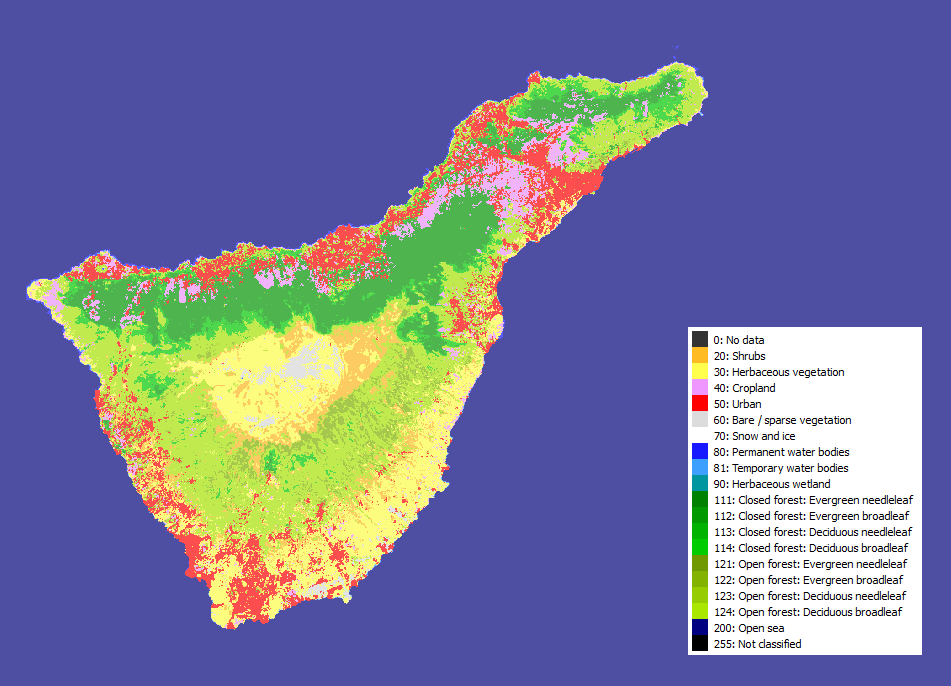
| 00:48, 5 April 2018 | Tenerife CGLS-LC100.png (file) |  |
84 KB | 1 | |
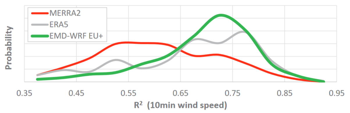
| 15:08, 25 June 2019 | EMDWRF EuropePlus Propability.png (file) |  |
85 KB | 1 | |
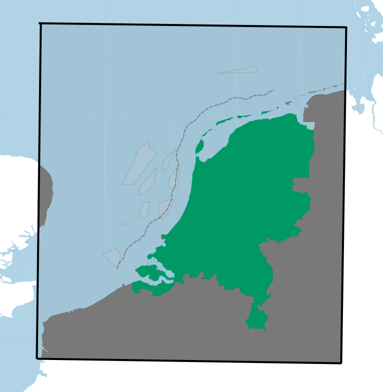
| 13:34, 24 September 2018 | KNW-DomainEMD.png (file) |  |
88 KB | 1 | |
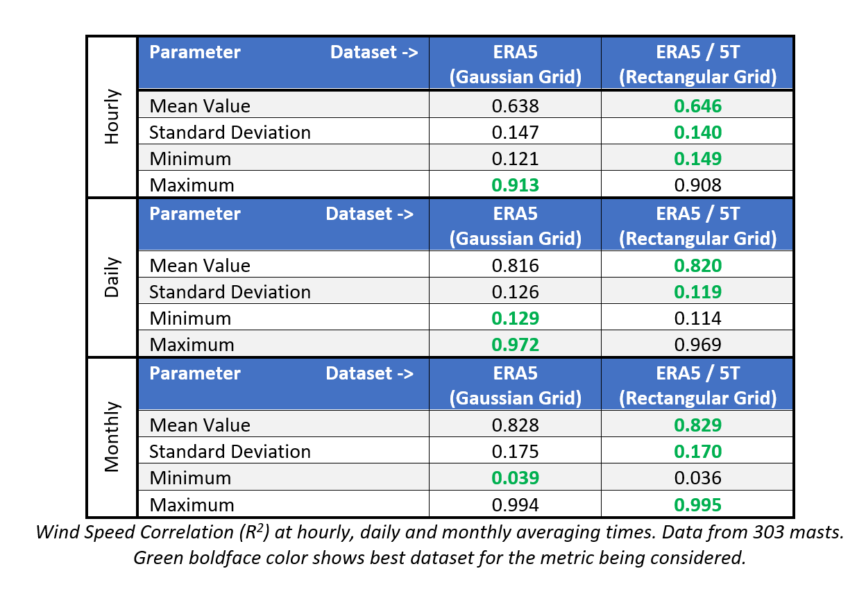
| 19:00, 8 January 2020 | ERA5 RectangularVsGaussianGrid.png (file) |  |
92 KB | 1 | |
| 11:48, 11 January 2019 | MS-NFI-Licence.pdf (file) | 93 KB | 1 | ||
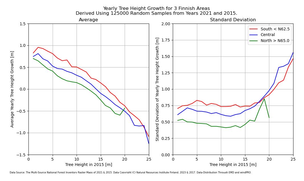
| 10:54, 6 October 2023 | 3 TreeHeightGrowth.JPG (file) |  |
94 KB | 1 | |
| 13:22, 26 May 2013 | NARRmodelGrid.png (file) |  |
94 KB | 1 | |
| 18:32, 7 February 2021 | 20210204 python generated atlasdata.0.2.0.zip (file) | 96 KB | 1 | ||
| 14:39, 5 October 2021 | SwissTopo AlgemeineNutzbedingungen.pdf (file) | 96 KB | 1 | ||
| 18:38, 10 February 2016 | EMD-WRF SouthKorea-ProductSheet.pdf (file) | 101 KB | 1 | ||
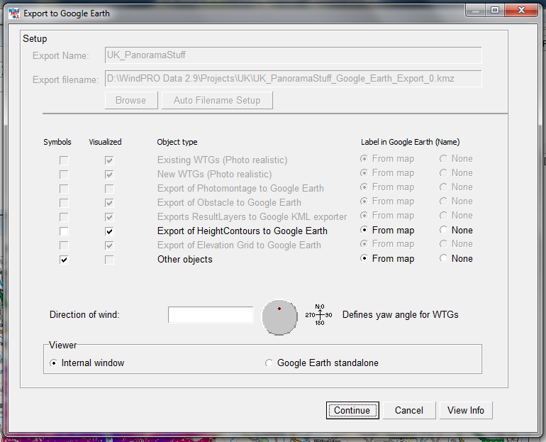
| 18:41, 29 May 2013 | GoogleExport Settings.png (file) |  |
102 KB | 1 | |
| 14:46, 28 May 2019 | PDF-LV.pdf (file) | 108 KB | 1 | ||
| 10:56, 21 September 2021 | Windturbines-error.png (file) |  |
110 KB | 1 | |
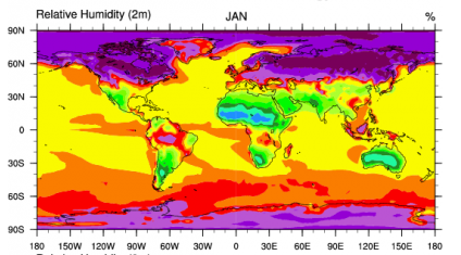
| 15:39, 26 May 2013 | CFSR RelativeHumidity.png (file) |  |
111 KB | 1 | |
| 14:46, 28 May 2019 | PDF-UK.pdf (file) | 111 KB | 1 | ||
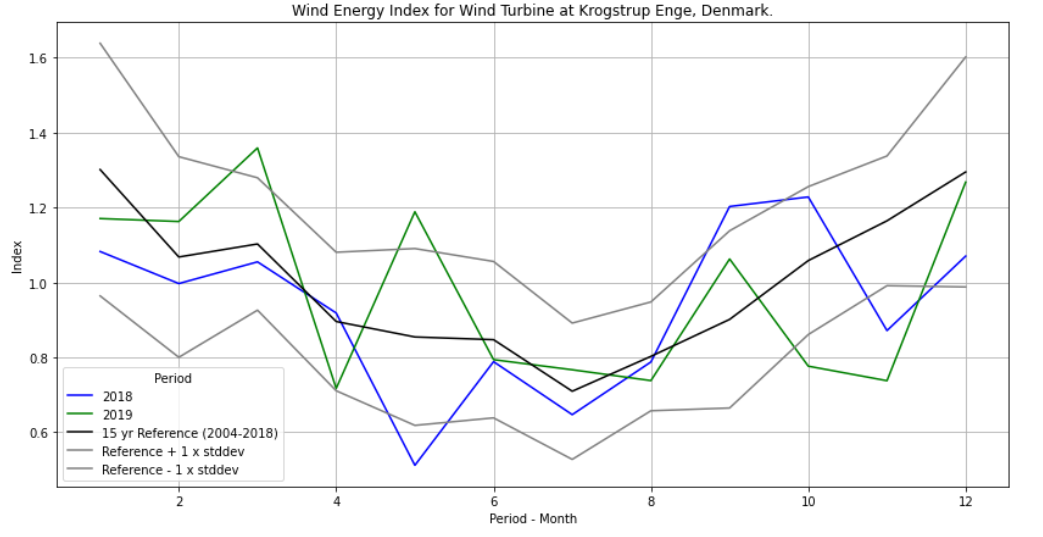
| 16:06, 17 December 2020 | Windindex krogstrupenge.png (file) |  |
112 KB | 1 | |
| 01:01, 7 December 2020 | 20201206 python client generated.zip (file) | 113 KB | 1 | ||
| 17:22, 6 December 2021 | 20211201 ECMWF ERA5T Notification.pdf (file) | 115 KB | 2 | ||
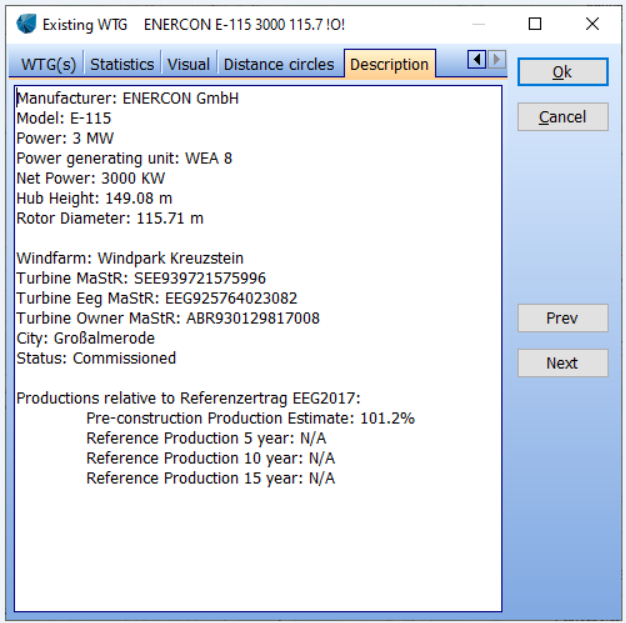
| 10:01, 14 April 2020 | Wtg long description.png (file) |  |
121 KB | 3 | |
| 15:24, 26 May 2013 | CFSRlogo.png (file) |  |
125 KB | 1 | |
| 17:43, 25 May 2013 | SynopNorthSea.png (file) |  |
125 KB | 1 | |
| 22:54, 26 May 2013 | MapData Example.png (file) |  |
130 KB | 1 | |
| 12:11, 30 August 2017 | CorrelationGraph.png (file) |  |
132 KB | 1 | |
| 14:50, 1 April 2022 | Seasonal.png (file) |  |
148 KB | 1 | |
| 10:01, 23 May 2013 | SRTMCoverage.png (file) |  |
157 KB | 1 | |
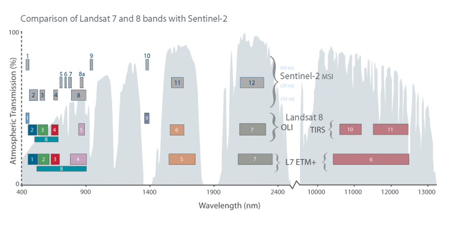
| 10:43, 24 October 2017 | SpectralBands Sentinel2andLandsat7.png (file) |  |
159 KB | 1 | |
| 19:04, 2 January 2023 | Terms Of Use DenmarksDepthModel.pdf (file) | 162 KB | 1 | ||
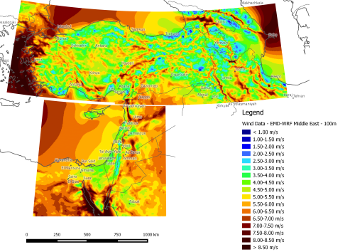
| 22:15, 17 February 2016 | EMDWRF MiddleEast.png (file) |  |
163 KB | 2 | |
| 23:01, 17 February 2016 | EmdWrfMiddleEast.png (file) |  |
163 KB | 1 | |
| 13:24, 27 December 2022 | Licence-to-use-copernicus-products.pdf (file) | 163 KB | 1 | ||
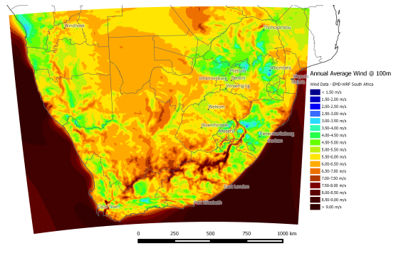
| 16:38, 19 February 2016 | SouthAfrica100mWinds.png (file) |  |
163 KB | 2 | |
| 10:33, 10 April 2024 | EMODnet2022.png (file) |  |
164 KB | 1 | |
| 09:20, 6 August 2021 | 20210806 TurbulenceFromGASPdata.pdf (file) | 168 KB | 1 | ||
| 09:39, 30 November 2021 | MERRA2 Issue NASA 2021-11.pdf (file) | 169 KB | 1 | ||
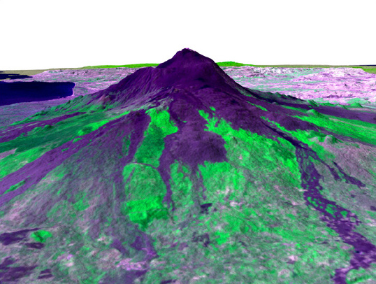
| 14:05, 23 May 2013 | AsterMountEtna.jpg (file) |  |
169 KB | 1 | |
| 12:29, 17 February 2022 | 20220216 AccuracyRASP.pdf (file) | 170 KB | 3 | ||
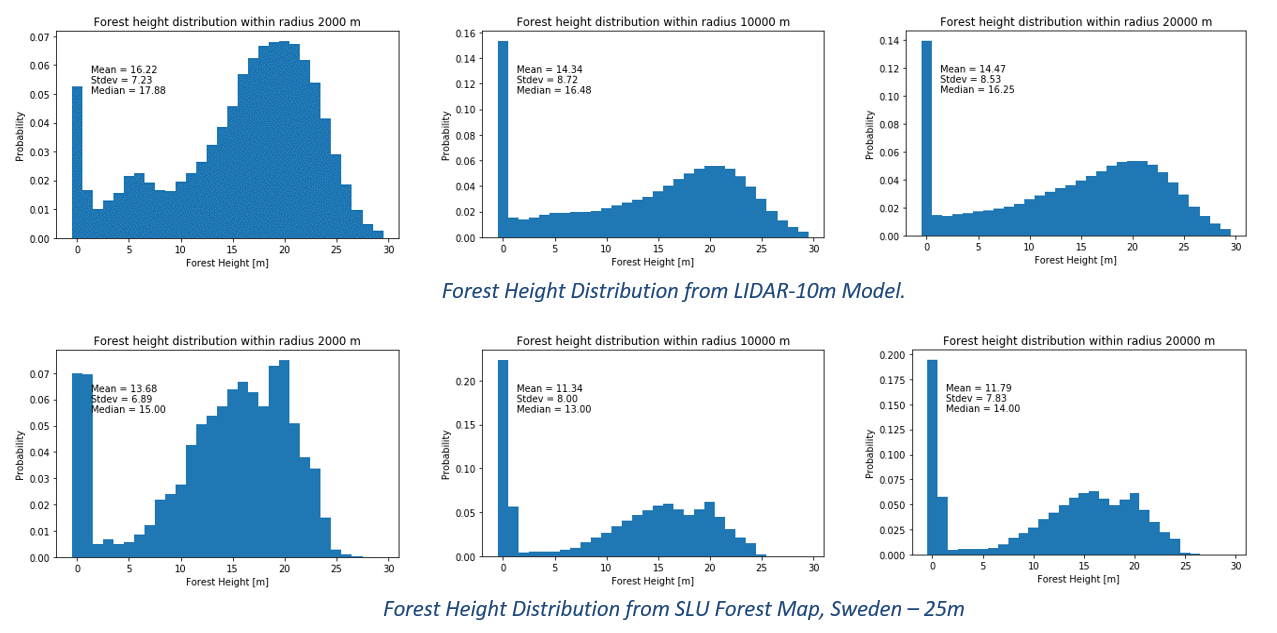
| 12:07, 28 June 2018 | ForestHeightDistribution SLUvsLIDAR.png (file) |  |
171 KB | 1 | |
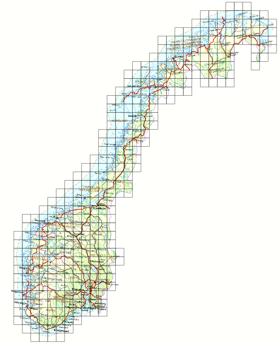
| 10:40, 30 March 2021 | Norway coverage.png (file) |  |
172 KB | 1 | |
| 13:10, 25 September 2019 | WorldDEM.png (file) |  |
174 KB | 1 | |
| 18:03, 29 May 2013 | DKWindIndex Version06.pdf (file) | 175 KB | 1 | ||
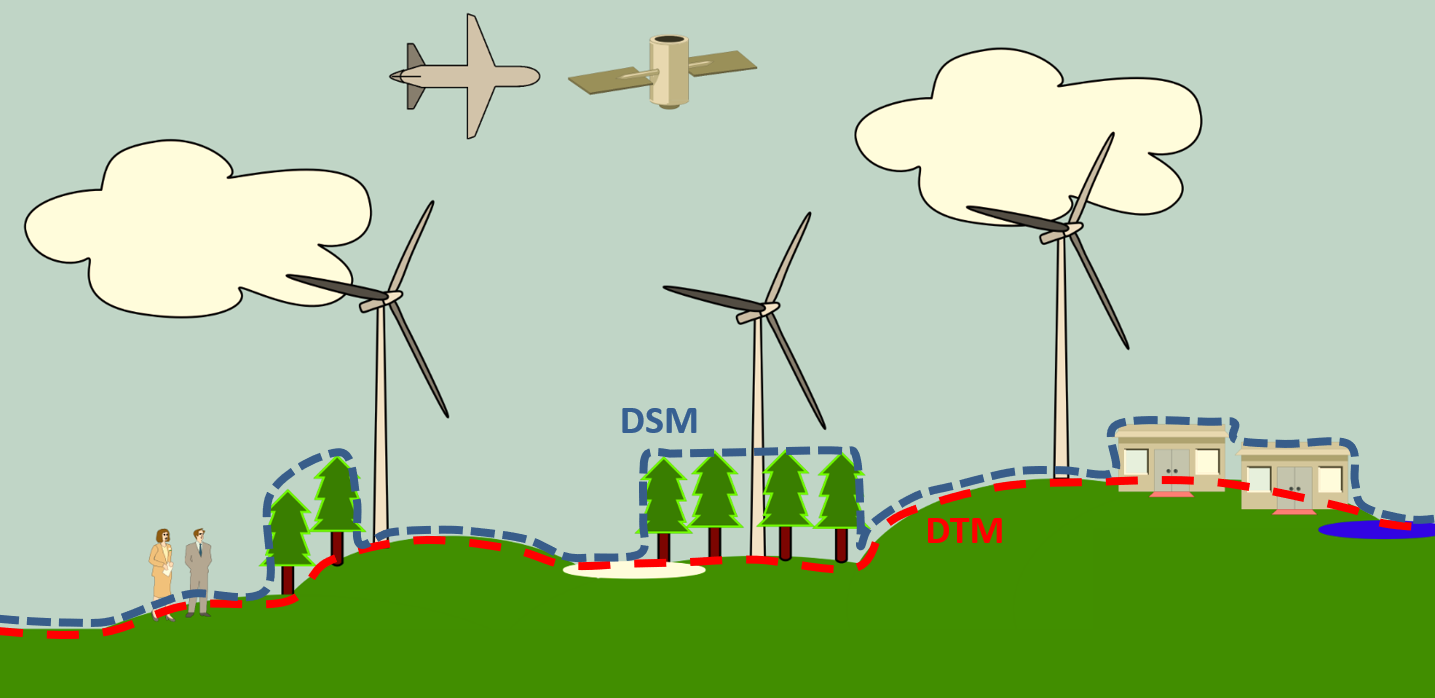
| 12:17, 23 September 2019 | ElevationModels DSM-DTM-DEM 2019.png (file) |  |
178 KB | 1 | |
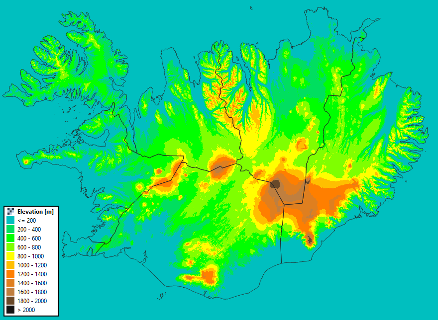
| 10:42, 30 May 2022 | Iceland ElevationModel.png (file) |  |
179 KB | 1 | |
| 23:18, 16 March 2020 | SolarPV.png (file) |  |
179 KB | 1 | |
| 00:13, 29 May 2013 | TurbineCatalogue Sample.png (file) |  |
180 KB | 1 | |
| 12:48, 23 May 2013 | SRTMNorthernIreland.png (file) |  |
184 KB | 1 | |
| 17:57, 29 May 2013 | DKWindIndex NewMethod2003.pdf (file) | 185 KB | 1 | ||
| 19:51, 9 January 2023 | GEBCO 2022 Grid.pdf (file) | 186 KB | 1 | ||
| 15:35, 22 May 2013 | 800px-Aterrizaje endeavour.jpg (file) |  |
188 KB | 1 | |
| 13:16, 27 November 2021 | GEBCO 2021 Grid.pdf (file) | 191 KB | 1 |