Spanish Topographic Map: Difference between revisions
No edit summary |
|||
| (3 intermediate revisions by one other user not shown) | |||
| Line 11: | Line 11: | ||
== License and Attribution == | == License and Attribution == | ||
The product belongs to the open data of the National Geographic Institute of Spain. The data have been uncer a license compatible with the Creative Commons Attribution 4.0 International License. More information can be found in the ministry order which can be accessed from the links below. Please accept the license conditions and use a proper attribution when using this dataset, such as: | The product belongs to the open data of the National Geographic Institute of Spain. The data have been uncer a license compatible with the Creative Commons Attribution 4.0 International License. More information can be found in the ministry order which can be accessed from the links below. <br> | ||
Please accept the license conditions and use a proper attribution when using this dataset, such as:<br> | |||
Contains elevation data from the Spanish Instituto Geográfico Nacional (IGN). Distribution through EMD and windPRO. CC-BY 4.0 ign.es. | Contains elevation data from the Spanish Instituto Geográfico Nacional (IGN). Distribution through EMD and windPRO. CC-BY 4.0 ign.es. | ||
| Line 19: | Line 20: | ||
== Acknowledgement == | == Acknowledgement == | ||
* The National Geographic Institute of Spain (Instituto Geográfico Nacional, IGN) are thanked for producing this digital elevation dataset – and disseminating it in the public domain and thus for aiding the development of renewable energy. | * The National Geographic Institute of Spain (Instituto Geográfico Nacional, IGN) are thanked for producing this digital elevation dataset – and disseminating it in the public domain and thus for aiding the development of renewable energy. | ||
* Integration of this dataset into EMD services | * Integration of this dataset into EMD services was co-supported through the InnoWind project ([http://www.innowind.dk www.innowind.dk) which is co-funded by the Danish Innovation Fund | ||
== External Links == | == External Links == | ||
* Description of the elevation models: http://centrodedescargas.cnig.es/CentroDescargas/ | * Description of the elevation models: http://centrodedescargas.cnig.es/CentroDescargas/ | ||
* InnoWind project - http://www.innowind.dk | * InnoWind project - http://www.innowind.dk | ||
Latest revision as of 11:05, 17 January 2020

Introduction
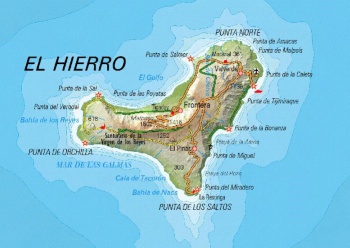
The Spanish Topographic Maps are a part of the dynamic, zoomable maps available in windPRO. The maps were developed by the National Geographic Institute of Spain (Instituto Geográfico Nacional, IGN) - and the dynamic map service in windPRO holds scales of 1:50000, 1:200000, 1: 500000 and 1:1250000. Coverage is the whole of Spain.
Usage Notes
- The map was derived from source data accessed in January 2019
Availability from within windPRO
- From map window: Click the ‘Add map’ globe-icon -> then ‘Dynamic Maps’
- From main menu: Click ‘Project’ -> ‘Properties’ -> ‘Background Maps’ -> ‘Dynamic Maps’
License and Attribution
The product belongs to the open data of the National Geographic Institute of Spain. The data have been uncer a license compatible with the Creative Commons Attribution 4.0 International License. More information can be found in the ministry order which can be accessed from the links below.
Please accept the license conditions and use a proper attribution when using this dataset, such as:
Contains elevation data from the Spanish Instituto Geográfico Nacional (IGN). Distribution through EMD and windPRO. CC-BY 4.0 ign.es.
Acknowledgement
- The National Geographic Institute of Spain (Instituto Geográfico Nacional, IGN) are thanked for producing this digital elevation dataset – and disseminating it in the public domain and thus for aiding the development of renewable energy.
- Integration of this dataset into EMD services was co-supported through the InnoWind project ([http://www.innowind.dk www.innowind.dk) which is co-funded by the Danish Innovation Fund
External Links
- Description of the elevation models: http://centrodedescargas.cnig.es/CentroDescargas/
- InnoWind project - http://www.innowind.dk