WindPRO Global Satellite Imagery: Difference between revisions
| Line 16: | Line 16: | ||
== Access, Resolution and Coverage == | == Access, Resolution and Coverage == | ||
* Access: Is from within the 'Dynamic Maps' section in the windPRO background map area. You need a windPRO version 3.2+ to access the data. | * Access: Is from within the 'Dynamic Maps' section in the windPRO background map area. You will need a windPRO version 3.2+ and and active service agreement to access the data. | ||
* Resolution: The maximum spatial resolution is 10 m per pixel. Most data are from the period 2016 and later. | * Resolution: The maximum spatial resolution is 10 m per pixel. Most data are from the period 2016 and later. | ||
* Coverage: The "WindPRO World Satellite Imagery" dataset covers most of the globe, except the ocean areas. | * Coverage: The "WindPRO World Satellite Imagery" dataset covers most of the globe, except the ocean areas. | ||
Revision as of 12:49, 24 October 2017

Introduction

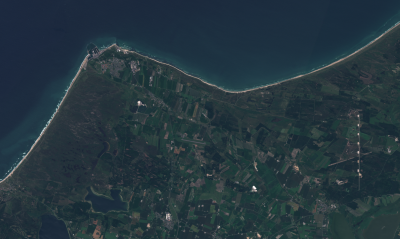
With the release of the data-set "windPRO World Satellite Imagery - 10m", users of windPRO 3.2 now have free access to high-resolution, reliable and near-real time satellite images from anywhere in the world. The color images of terrain, vegetation and urban areas can be a valuable aid when doing roughness classification studies or when you need fully updated maps for a particular area.
Dataset Description
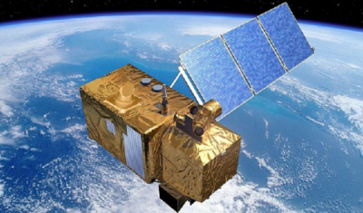
The two polar orbiting Sentinel-2 satellites are a part of the Copernicus Earth Observation system – a large multi-billion euro EU infrastructure project. The 2A-satellite was launched in june 2015 and the 2B in march 2017. Both satellites deliver high-resolution multi-spectral images (in 12 spectral bands) – and has a revisit time of 5 days of any part of the world (but may – off cause – could contain some clouds). Resolution of the satellite imagery is dependent on spectral band and ranging from 10 m to 60 m. The different spectral bands can be combined to provide images with specific purposes, e.g. true-color (RGB-images), highlighting urban areas or vegetation.
Our "windPRO World Satellite Imagery – 10m" dataset is currently a preview dataset only.
It holds a (near) cloud free dataset based on recent Sentinel-2 satellite imagery and it is available from our windPRO 3.2 release. We are continuously updating the dataset as new satellite images become available - so expect significant improvements. At present, a true-color imagery map is available. More false-color images may be added later to ease identification of urban and vegetation areas.
Access, Resolution and Coverage
- Access: Is from within the 'Dynamic Maps' section in the windPRO background map area. You will need a windPRO version 3.2+ and and active service agreement to access the data.
- Resolution: The maximum spatial resolution is 10 m per pixel. Most data are from the period 2016 and later.
- Coverage: The "WindPRO World Satellite Imagery" dataset covers most of the globe, except the ocean areas.
Known Issues

Please note, that this is a preview data-set, so data sources and images are still being obtained and processed. So currently, you will might see a few areas to hold inconsistencies, such as:
- No data coverage - as data has still not been downloaded
- Various levels of cloud cover - as a cloud free image might not exists
- Very dark or light areas - as brightness adjustment has not yet been made
License and Acknowledgement
- The European Commission and the European Space Agency are acknowledged for the development and release of the free and open Sentinel-2 data.
- Developement of this dataset was supported through the InnoWind project (www.innowind.dk), which is co-funded by the Danish Innovation Fund
Attribution
Proper attribution for this data-set would be: "WindPRO World Satellite Imagery - 10m by EMD International A/S (Contains modified Copernicus Sentinel data 2016 & 2017)".
External Links
Innowind Project: http://www.innowind.dk/
Copernicus Data: http://copernicus.eu/