Google Earth Export: Difference between revisions
No edit summary |
m (→How to do it: Added comment on turbine visualisations in the internal GE viewer.) |
||
| Line 12: | Line 12: | ||
[[File:GoogleIcon_Export.png|left|200px|thumb|Where to click]] | [[File:GoogleIcon_Export.png|left|200px|thumb|Where to click]] | ||
Simply click the small Google-Icon in the tool-bar in 'Maps and Objects' to invoke the export. | Simply click the small Google-Icon in the tool-bar in 'Maps and Objects' to invoke the export. | ||
Please note that when using the embedded Google Earth window within WindPRO, the representations of the turbine models use a generic shape rather than the visual data from the wtg catalogue. | |||
Revision as of 12:40, 6 June 2013

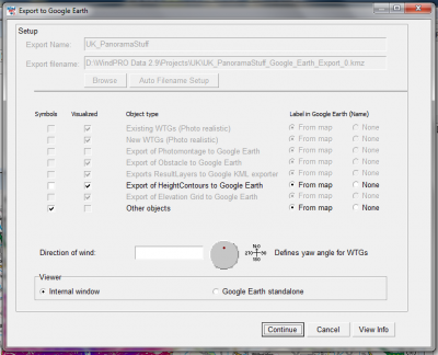
It is possible to export your wind turbine positions (and other data) directly into Google Earth and to let WindPRO maintain a synchronization link - so that if you change anything in the WindPRO maps, then you will immediately also see it also in Google Earth. You will have the option of seeing the data in a browser embedded into WindPRO or as a stand-alone Google Earth instance.
Required Software
- WindPRO 2.9
- Google Earth
Data License
The End User License Agreement for Google Earth is available here: http://earth.google.com/intl/en-US/license.html
How to do it

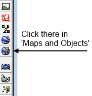
Simply click the small Google-Icon in the tool-bar in 'Maps and Objects' to invoke the export.
Please note that when using the embedded Google Earth window within WindPRO, the representations of the turbine models use a generic shape rather than the visual data from the wtg catalogue.