ÜSTÜN windPROSPER maps: Difference between revisions
m (→Links) |
m (→Links) |
||
| Line 21: | Line 21: | ||
== Links == | == Links == | ||
* ÜSTÜN Energy Engineering - WindPROSPER | * ÜSTÜN Energy Engineering - WindPROSPER maps: http://ustunenerji.com/en/maps/ | ||
* EMD-WRF Europe+ - WindPROSPER mesoscale wind map and time-series data at this [http://help.emd.dk/mediawiki/index.php?title=EMD-WRF_Europe%2B wiki] | * EMD-WRF Europe+ - WindPROSPER mesoscale wind map and time-series data at this [http://help.emd.dk/mediawiki/index.php?title=EMD-WRF_Europe%2B wiki] | ||
* WindPROSPER at [https://www.eurostars-eureka.eu/project/id/10037 Eurostars] | * WindPROSPER at [https://www.eurostars-eureka.eu/project/id/10037 Eurostars] | ||
* EMD participation in WindPROSPER was co-funded by Innovation Fund Denmark - https://innovationsfonden.dk | * EMD participation in WindPROSPER was co-funded by Innovation Fund Denmark - https://innovationsfonden.dk | ||
Revision as of 10:47, 15 October 2019


Introduction
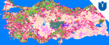
EMD International Denmark has formed partnership with Technical University of Denmark and ÜSTÜN Energy Engineering LLC from Turkey to within the Eurostars project “windPROSPER” between 2016 and 2018. In early 2019 final products have started to be implemented into windPRO, with EMD releasing the ERA5-based EMD-WRF Europe+ mesoscale wind map. The “ÜSTÜN windPROSPER Maps” is another of the outputs of the project and it delivers high quality, up-to-date roughness maps of Turkey. The maps are possible to be added to your windPRO as a module with yearly subscription and it will be updated every one or two years. In windPRO, the following maps are available:
- Roughness maps
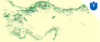
- Tree height maps
The roughness and tree height maps were derived from satellite images and local digitized maps through a detailed study encompassing both urban and vegetated areas. With the ÜSTÜN windPROSPER maps, you can have the most realistic, up-to-date roughness map of Turkey and Denmark ready to use in your windPRO application and modules. The tree height database includes the 47 most common tree types of Turkey as well as the non-vegetated areas.
Coverage
ÜSTÜN windPROSPER maps currently covers the following domains:
- Turkey
- Denmark
Validation
Current model that has been developed and validated by ÜSTÜN Energy Engineering LLC has also become subject of scientific publications. The applied forest model is published in an SCI-Expanded indexed journal this month in open access format. (https://onlinelibrary.wiley.com/doi/10.1002/ese3.496)
Contact
In order to get access to the data - all you need to do for registration is to contact ÜSTÜN Energy Engineering in Turkey www.USTUNEnerji.com and fill out a short form with your company information and windPRO license number. In a few days time, your maps will be available directly in windPRO when accessing the windPRO online-services.
Links
- ÜSTÜN Energy Engineering - WindPROSPER maps: http://ustunenerji.com/en/maps/
- EMD-WRF Europe+ - WindPROSPER mesoscale wind map and time-series data at this wiki
- WindPROSPER at Eurostars
- EMD participation in WindPROSPER was co-funded by Innovation Fund Denmark - https://innovationsfonden.dk