Web Map Service: Difference between revisions
Jump to navigation
Jump to search
mNo edit summary |
|||
| Line 8: | Line 8: | ||
You may add your own WMS servers in addition to the list provided by the EMD-server. | You may add your own WMS servers in addition to the list provided by the EMD-server. | ||
Below is a list of samples | Below is a WMS-services list of samples from WindPRO. | ||
Note, that WindPRO will - by default - only show the datasets where data are available considering the location of your project. | Note, that WindPRO will - by default - only show the datasets where data are available considering the location of your project. | ||
This (server-side generated list) may be updated at any time, so your windPRO instance may hold more or less WMS map services. | |||
* Austrian DOP 8 m resolution from http://gis.lebensministerium.at | * Austrian DOP 8 m resolution from http://gis.lebensministerium.at | ||
* Austrian topography in Salzburg state from http://service.salzburg.gv.at | * Austrian topography in Salzburg state from http://service.salzburg.gv.at | ||
Revision as of 07:48, 19 September 2023

From WindPRO 2.9 it is now possible to add map-services from a WMS-server (Web Map Server).
A Web Map Service (WMS) is a standard protocol for serving georeferenced map images over the Internet. The maps are generated by a map server using data from a GIS database.
WMS Data Sources
You may add your own WMS servers in addition to the list provided by the EMD-server.
Below is a WMS-services list of samples from WindPRO. Note, that WindPRO will - by default - only show the datasets where data are available considering the location of your project. This (server-side generated list) may be updated at any time, so your windPRO instance may hold more or less WMS map services.
- Austrian DOP 8 m resolution from http://gis.lebensministerium.at
- Austrian topography in Salzburg state from http://service.salzburg.gv.at
- Austrian topography in Upper Austria state (1:50000) from http://ags.doris.at
- Austrian topography in Carinthia state (1:50000) from http://gis.ktn.gv.at
- Austrian streets and names in Lower Austria state from http://www.intermap1.noel.gv.at
- Austrian administrative boundaries in Tirol state from http://gis.tirol.gv.at/
- Czech topography from http://www.bnhelp.cz
- Danish maps (DTK) from http://kortforsyningen.kms.dk
- Danish orthophotos from http://kortforsyningen.kms.dk
- Danish raster topo-maps (in scales 1:25000, 1:50000 and 1:100000) from http://kortforsyningen.kms.dk
- Danish Cadastral Maps from http://kortforsyningen.kms.dk
- European maps from http://osm.wheregroup.com/
- German ATKIS maps from http://www.onmaps.de (requires license from onmaps)
- German topography 1:10000 and 1:50000 from http://www.wms.nrw.de
- Latvia maps from http://www.gisnet.lv
- Romanian maps from http://earth.unibuc.ro
- Switzerland topography 1:1000000 and more from http://wms.geo.admin.ch
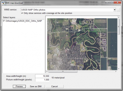
- United States National Agriculture Imagery Program (NAIP) Orthophotos from http://raster.nationalmap.gov
- United States Naval Research Laboratory maps from http://geoint.nrlssc.navy.mil