UK-Land-Form PANORAMA: Difference between revisions
Jump to navigation
Jump to search
No edit summary |
|||
| Line 1: | Line 1: | ||
[[Category: Online Data]][[Category: Digital Elevation Models]] | [[Category: Online Data]][[Category: Digital Elevation Models]] | ||
== Introduction == | == Introduction == | ||
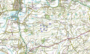
[[File:LandFormPANORAMA. | [[File:LandFormPANORAMA.jpg|right|300px|thumb|Land-Form PANORAMA data shown at the Milton Keynes Wind Farm]]The Land-Form PANORAMA is a digital elevation dataset for Great Britain: Two versions of the dataset exists: one vector-dataset that provides height contours with a 10 m vertical spacing and one gridded dataset with a grid-spacing of 50 m. | ||
== Data Type == | == Data Type == | ||
Revision as of 20:30, 23 May 2013
Introduction

The Land-Form PANORAMA is a digital elevation dataset for Great Britain: Two versions of the dataset exists: one vector-dataset that provides height contours with a 10 m vertical spacing and one gridded dataset with a grid-spacing of 50 m.
Data Type
Raw vector data is stored in the DXF-format. Grid data is stored in either ASCII-Grid or NTF-format.
Coverage
This dataset covers the whole Great Britain.
Licence
The data is distributed according to the OS OpenData terms File:OsOpenDataTerms.pdf. Please take proper care to add the
Acknowledgement
The dataset is available in WindPRO by courtesy of Jonathan de Ferranti and his website www.viewfinderpanoramas.org.
External Links
- Original data is available from the web-page of the Ordnance Survey http://www.ordnancesurvey.co.uk/oswebsite/products/land-form-panorama/index.html.
- [
External Links
- OS OpenData Terms / Licence is available here: http://www.ordnancesurvey.co.uk/oswebsite/docs/licences/os-opendata-licence.pdf.