European EMODnet Bathymetry: Difference between revisions
No edit summary |
No edit summary |
||
| Line 13: | Line 13: | ||
The following reference system was used in the original data: | The following reference system was used in the original data: | ||
* Geo [deg,min] - WGS84 | * Geo [deg,min] - WGS84 | ||
== Coverage == | |||
* The Greater North Sea, including the Kattegat and stretches of water such as Fair Isle, Cromarty, Forth, Forties, Dover, Wight, and Portland | |||
* The English Channel and Celtic Seas | |||
* Western and Central Mediterranean Sea and Ionian Sea | |||
* Bay of Biscay, Iberian coast and North-East Atlantic | |||
* Adriatic Sea | |||
* Aegean - Levantine Sea (Eastern Mediterranean) | |||
* Azores - Madeira EEZ | |||
* Canary Islands | |||
* Baltic Sea | |||
* Black Sea | |||
* Norwegian – Icelandic seas | |||
== License and Attribution == | == License and Attribution == | ||
Revision as of 09:40, 18 February 2019


Introduction
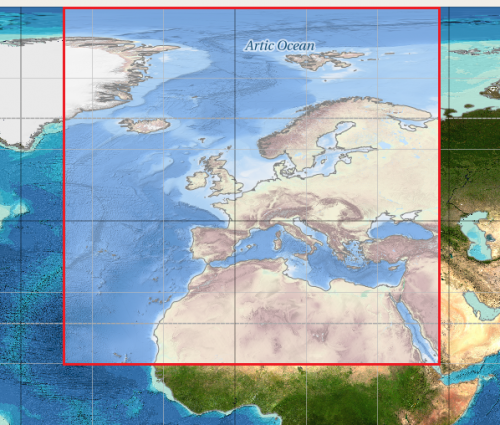
The "EMODnet Digital Bathymetry (DTM)" is a multilayer bathymetric product for Europe’s sea basins containing water depths. The DTM is based upon more than 7700 bathymetric survey data sets and Composite DTMs that have been gathered from 27 data providers from 18 European countries. The DTM has a grid resolution of 1/8 * 1/8 arc minutes (roughly 230 * 230 meters).
Availability from within WindPRO
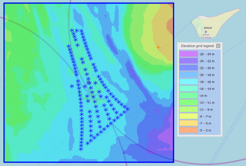
The data is available directly from within windPRO and can be accessed from the online-services in the Elevation Grid Object.
Reference System
The following reference system was used in the original data:
- Geo [deg,min] - WGS84
Coverage
- The Greater North Sea, including the Kattegat and stretches of water such as Fair Isle, Cromarty, Forth, Forties, Dover, Wight, and Portland
- The English Channel and Celtic Seas
- Western and Central Mediterranean Sea and Ionian Sea
- Bay of Biscay, Iberian coast and North-East Atlantic
- Adriatic Sea
- Aegean - Levantine Sea (Eastern Mediterranean)
- Azores - Madeira EEZ
- Canary Islands
- Baltic Sea
- Black Sea
- Norwegian – Icelandic seas
License and Attribution
Please use the following attribution when using this dataset:
EMODnet Bathymetry Consortium (2016): EMODnet Digital Bathymetry (DTM).
http://doi.org/10.12770/c7b53704-999d-4721-b1a3-04ec60c87238
Additionally, there is a disclaimer: http://www.emodnet-bathymetry.eu/internal_html/disclaimer/10
Acknowledgement
The European Marine Observation and Data Network (EMODnet) is thanked for producing this digital elevation dataset – and disseminating it in the public domain and thus for aiding the development of renewable energy.
External Links
Description of the EMODnet Bathymetry data set: http://www.emodnet-bathymetry.eu/data-products