Bing Aerial Maps


Introduction
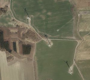
Bing Aerial Maps in windPRO provides amazing, high-resolution aerial imagery for most parts of the world. Coverage varies by area, country, and region. The Bing Maps team continuously updates this aerial imagery dataset.
Usage Notes
- The Microsoft Bing Aerial Maps are provided with windPRO 4.0 (beta) as an experimental feature.
- For information about map updates, please consult the Bing Maps blog.
- Billing of the Bing Aerial Maps in windpRO is covered as part of your windPRO service subscription - as long as your usage is compliant with the "Microsoft Bing Maps Services Terms of Use"
Availability from within windPRO
- From map window: Click the ‘Add map’ globe-icon -> then ‘Dynamic Maps’.
- From main menu: Click ‘Project’ -> ‘Properties’ -> ‘Background Maps’ -> ‘Dynamic Maps’ -> 'Bing Aerial Maps'
License and Attribution
Use of this layer and maps created with it implies agreement with the terms and conditions of the Microsoft Bing Maps Services License [here and here. EMD holds a "Developer License" that covers use of bing-maps within windPRO.
Acknowledgement
- A big thank you goes to the Microsoft Bing Maps team and its data providers - for producing this amazing digital dataset: It surely helps us in the development of renewable energy projects.