Corine Land Cover
Introduction


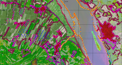
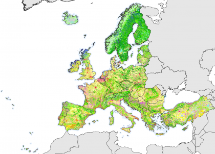
Corine land cover products in windPRO are data-layers from years 2006, 2012 and 2018. National centres for land-cover analysis are producing the datasets - with the majority of the national authorities using visual interpretation of high resolution satellite imagery. In some countries other semi-automatic methods are applied using national in-situ data, satellite imagery and GIS-tools. The dataset has a legend with 44 classes of land-cover. These have been mapped in to roughness lengths for use in WindPRO. It is produced and delivered by the European Environment Agency (EEA) - http://www.eea.europa.eu/ through the Copernicus Land Monitoring Service.
Dataset Overview
- Spatial Coverage: This dataset covers most parts of Europe, with the recent version coverage of 39 countries.
- Resolution: 100 m.
- Data Type: Land Cover / Land Use Mapping - with roughness length mapping by EMD (lookup table)
- Versions:
- 2018: Representing a time consistency 2017 - 2018
- 2012: Representing a time consistency 2011 - 2012
- 2006: Representing a time consistency 2006 +/- 1 year
- Geomeric Accuracy (Satellite Data):
- 2018: <10m (based on Sentinel-2 imagery)
- 2012: <25m
- 2006: <25m
- Thematic Accuracy: >85%
Availability from within WindPRO
The data are available directly from within windPRO. The data can be accessed from the online-services in the following objects:
- Area Object (with purpose set to 'roughness map based on closed lines')
- Line Object (with purpose set to 'roughness lines')
Please note: Data stored in the 'Area Object' can be (fairly) easily edited by changing the legend / lookup-table definitions - as this data-type preserves the original metadata (land cover groups). This is not possible when loading roughness-lines data directy in the line object.
Usage Notes
- Always make a manual evaluation and adjustment of the roughness lengths obtained from this dataset; they are based on a simplified lookup table (as seen below) and you may find that any in-situ values will differ from the model values obtained from the lookup table.
- If you want to modify the values obtained: Load the data into a windPRO area object.
Legends
The Corine Land Cover Datasets (2006, 2012 and 2018) datasets have 44 different categories that EMD has mapped in to a suggested roughness length, z0. The values from the column 'EMD Roughness Length' in the lookup-table (LUT) below are used as defaults when the data is loaded into the area-object or line-object. The comparson to the DTU default LUT-values are shown as an additional column. This is done to highlight that the lookup-table values are uncertain, and likely to be dependent of the geographical region where they are applied and also the expert making the estimate. As such, the used values should be validated, e.g. using local mast data (the wind profile) and by cross-predictions between masts.
| No | Land Cover Type | EMD Roughness Length |
DTU Roughness Length |
|---|---|---|---|
| 1 | Continuous urban fabric 1.1.1 | z0=0.50000 | z0=1.00000 |
| 2 | Discontinuous urban fabric 1.1.2 | z0=0.40000 | z0=0.80000 |
| 3 | Industrial or commercial units 1.2.1 | z0=0.70000 | z0=0.70000 |
| 4 | Road and rail networks and associated land 1.2.2 | z0=0.10000 | z0=0.10000 |
| 5 | Port areas 1.2.3 | z0=0.50000 | z0=0.50000 |
| 6 | Airports 1.2.6 | z0=0.03000 | z0=0.01000 |
| 7 | Mineral extraction sites 1.3.1 | z0=0.10000 | z0=0.05000 |
| 8 | Dump sites 1.3.2 | z0=0.10000 | z0=0.05000 |
| 9 | Construction sites 1.3.3 | z0=0.30000 | z0=0.30000 |
| 10 | Green urban areas 1.4.1 | z0=0.40000 | z0=0.80000 |
| 11 | Sport and leisure facilities 1.4.2 | z0=0.50000 | z0=0.20000 |
| 12 | Non-irrigated arable land 2.1.1 | z0=0.05600 | z0=0.05000 |
| 13 | Permanently irrigated land 2.1.2 | z0=0.05600 | z0=0.03000 |
| 14 | Rice fields 2.1.3 | z0=0.01840 | z0=0.03000 |
| 15 | Vineyards 2.2.1 | z0=0.30000 | z0=0.30000 |
| 16 | Fruit trees and berry plantations 2.2.2 | z0=0.40000 | z0=0.40000 |
| 17 | Olive groves 2.2.3 | z0=0.40000 | z0=0.40000 |
| 18 | Pastures 2.3.1 | z0=0.03600 | z0=0.03000 |
| 19 | Annual crops associated with permanent crops 2.4.1 | z0=0.05600 | z0=0.10000 |
| 20 | Complex cultivation patterns 2.4.2 | z0=0.05600 | z0=0.15000 |
| 21 | Land principally occupied by agriculture, with significant areas of natural vegetation 2.4.3 | z0=0.05600 | z0=0.20000 |
| 22 | Agro-forestry areas 2.4.4 | z0=0.50000 | z0=0.50000 |
| 23 | Broad-leaved forest 3.1.1 | z0=0.50000 | z0=1.00000 |
| 24 | Coniferous forest 3.1.2 | z0=0.50000 | z0=1.20000 |
| 25 | Mixed forest 3.1.3 | z0=0.50000 | z0=1.10000 |
| 26 | Natural grassland 3.2.1 | z0=0.05600 | z0=0.03000 |
| 27 | Moors and heathland 3.2.2 | z0=0.06000 | z0=0.05000 |
| 28 | Sclerophyllous vegetation 3.2.3 | z0=0.05600 | z0=0.07000 |
| 29 | Transitional woodland-scrub 3.2.4 | z0=0.40000 | z0=0.40000 |
| 30 | Beaches, dunes, and sand plains 3.3.1 | z0=0.01000 | z0=0.00300 |
| 31 | Bare rock 3.3.2 | z0=0.05000 | z0=0.05000 |
| 32 | Sparsely vegetated areas 3.3.3 | z0=0.20000 | z0=0.03000 |
| 33 | Burnt areas 3.3.4 | z0=0.20000 | z0=0.20000 |
| 34 | Glaciers and perpetual snow 3.3.5 | z0=0.00500[1] | z0=0.00500 |
| 35 | Inland marshes 4.1.1 | z0=0.05000 | z0=0.05000 |
| 36 | Peat bogs 4.1.2 | z0=0.01840 | z0=0.03000 |
| 37 | Salt marshes 4.2.1 | z0=0.03480 | z0=0.02000 |
| 38 | Salines 4.2.2 | z0=0.03000 | z0=0.00500 |
| 39 | Intertidal flats 4.2.3 | z0=0.00050 | z0=0.00000 |
| 40 | River 5.1.1 | z0=0.00000 | z0=0.00000 |
| 41 | Lake 5.1.2 | z0=0.00000 | z0=0.00000 |
| 42 | Coastal lagoons 5.2.1 | z0=0.00000 | z0=0.00000 |
| 43 | Estuaries 5.2.2 | z0=0.00000 | z0=0.00000 |
| 44 | Sea and ocean 5.2.3 | z0=0.00000 | z0=0.00000 |
| 45 | NO DATA | z0=-1.00000 | N/A |
Licence and Acknowledgement
European Environment Agency (EEA) standard re-use policy applies: unless otherwise indicated, re-use of content on the EEA website for commercial or non-commercial purposes is permitted free of charge, provided that the source is acknowledged (http://www.eea.europa.eu/legal/copyright). Copyright holder: European Environment Agency (EEA).
The following parties are acknowledged:
- European Environment Agency (EEA) is acknowledged for the development and release of this free and open dataset.
- Integration of this dataset into EMD services was co-supported through the InnoWind project (www.innowind.dk) which is co-funded by the Danish Innovation Fund
External Links
- Corine 2018: https://land.copernicus.eu/pan-european/corine-land-cover/clc2018
- Corine 2012: https://land.copernicus.eu/pan-european/corine-land-cover/clc-2012
- Corine 2006: http://www.eea.europa.eu/data-and-maps/data/corine-land-cover-2006-raster
- InnoWind project - http://www.innowind.dk
Footnotes
- ↑ Before 2020-02-14, the z0 for class 3.3.5 (Glaciers and perpetual snow) was set to 0.2000. After this date it was revised to 0.005.