Global Sentinel-2 10m Canopy Height ETH


Introduction
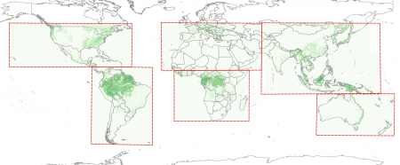
The "Global Sentinel-2 10m Canopy Height (ETH Zurich)" is a high-resolution forest canopy height dataset with full global data coverage. The data is representative for the year 2020 and it was created by a team of ETH researchers by using an artificial neural network (by fusing the two data-sources of GEDI and Sentinel 2 using a probabilistic deep learning model). Further documentation is available from an arXiv paper: Nico Lang, Walter Jetz, Konrad Schindler, and Jan Dirk Wegner. "A high-resolution canopy height model of the Earth." (arXiv:2204.08322 (2022)), see more below. .
Data Applicability and Availability within windPRO
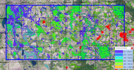
The forest height data are used as input for the dedicated sub-models in windPRO which includes the forest impact on the wind flow. These sub-models are the Displacement Height Calculator and the Objective Roughness Approach (ORA) tool; both models are available from windPRO 3.2+. The forest data is accessed from the online-services from the ‘Elevation Grid Object’ with data-type set to ‘Heights above terrain (a.g.l) for elements’. The data can be accessed from the online-services in the 'Elevation Grid Object' in the following way.
- Open the 'Elevation Grid Object'
- Set ‘Data type’ to ‘Digital Object Model - representation of the object heights (e.g. forest height)
- Click ‘Add Layer from Online Data‘
Technical Details
- Format: Geotiff
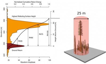
- Pixel values: Canopy top-height 2020 (m)
(RH98: the relative height where 98% of the energy has been returned, derived from GEDI L1B waveforms) - Spatial resolution: 0.0000833 degree (approximately 10 m)
- Geographical coverage: Full coverage of the globe
- Coordinate system: WGS84 geographic coordinates (in original data)
- Pixel values:
- 0-254: tree height in meters
- 255: no data value (not included in windPRO dataset)
- The 255 value is used to mask-out built-up areas, snow, ice and permanent water bodies
- Accuracy (see Lang et al):
- RMSE over all validation samples: 6.0m
- Bias over all validation samples: 1.3m
Usage Notes
- This mapping has focused on a correct mapping of tall trees.
- Low canopy heights are slightly over-estimated
License and Acknowledgement
The map has been released according to the Createive Commons by Attribution 4.0 License: The Global Land Analysis and Discovery Laboratory (GLAD) at the Department of Geographical Sciences at the University of Maryland has made the data available free of charge. We recommend using the following attribution when using the data:
Source:
Global forest height data from the Global Land Analysis and Discovery Laboratory (GLAD).
GLAD is at the Department of Geographical Sciences at the University of Maryland, USA.
Processing and distribution through EMD and windPRO.
External Links and References
- Nico Lang, Walter Jetz, Konrad Schindler, and Jan Dirk Wegner. "A high-resolution canopy height model of the Earth." (arXiv:2204.08322 (2022)) - here-html or here-pdf
- ETH Zurich Newsletter - here
- GEDI instrument overview - here
- Global Sentinel-2 10m Canopy Height (ETH Zurich), 2020 - data home page - here