EU-DEM
Introduction

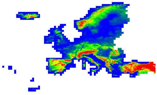
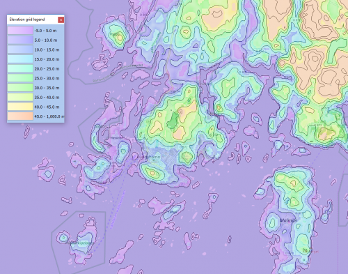
The EU-DEM is a pan-European digital elevation model covering European countries. It has a native grid resolution of 1 arc-second (approximately 30 meters). The dataset is void-filled and is created by a fuse of SRTM and ASTER GDEM by a weighted averaging approach. For areas outside SRTM coverage (north of 60 degrees), the dataset is primarily based on Russian topography sources.
Versions
The EU-DEM data available in windPRO is version 1.0. We are aware that a version 1.1 is being prepared; but this is still in an un-validated beta-release – along with a license that does not allow for re-distribution of the data. When the data has been finally released, we expect to release it with windPRO. Interested users can access the version 1.1 data from the external source-links below.
Coverage
This dataset covers the following countries: Albania, Austria, Belgium, Bosnia and Herzegovina, Bulgaria, Croatia, Cyprus, Czech Republic, Denmark, Estonia, Finland, France, Germany, Greece, Hungary, Iceland, Ireland, Italy, Kosovo, Latvia, Liechtenstein, Lithuania, Luxembourg, Macedonia the former Yugoslavian Republic of, Malta, Montenegro, Netherlands, Norway, Poland, Portugal, Romania, Serbia, Slovakia, Slovenia, Spain, Sweden, Switzerland, Turkey, United Kingdom.
Data Validation
A validation report is available from the EU-DEM team documenting an overall vertical root-mean-square-error of 2.9 m. Please note, there is a known issue that the EU-DEM dataset (as measure of ground topography) is less reliable when the terrain slope becomes steeper and the density of the tree cover increases. For more information, please see the link to the validation report below.
For any use of this data, we (EMD) recommend always to validate the height-contours with other data-sources (like high-resolution national topography maps).
License and Acknowledgement
The EU-DEM dataset is a realization of the Copernicus programme, managed by the European Commission, DG Enterprise and Industry. The following credit must be displayed when using these data:
- "Produced using Copernicus data and information funded by the European Union - EU-DEM layers. Distributed from EMD and windPRO."
The following parties are acknowledged:
- The European Commission, the European Environmental Agency (EEA) and the Copernicus Programme are acknowledged for the funding, development and release of the free and open dataset.
- Integration of this dataset into EMD services - was co-supported through the InnoWind project (www.innowind.dk), which is co-funded by the Danish Innovation Fund
Conditions of Access and Terms of Use

Access to data is based on a principle of full, open and free access as established by the Copernicus data and information policy regulation (EU) No 1159/2013 of 12 July 2013. Free, full and open access to this data set is made on the conditions that:
- When distributing or communicating Copernicus data and information to the public, users shall inform the public of the source of that data and information.
- Users shall make sure not to convey the impression to the public that the user's activities are officially endorsed by the Union.
- Where that data or information has been adapted or modified, the user shall clearly state this.
The regulation can be found here: http://eur-lex.europa.eu/legal-content/EN/TXT/?uri=CELEX%3A32013R1159
External Links
- EU-DEM at the European Environment Agency: http://www.eea.europa.eu/data-and-maps/data/eu-dem
- EU-DEM Statistical Validation Report, August 2014: http://land.copernicus.eu/user-corner/technical-library/eu-dem-2013-report-on-the-results-of-the-statistical-validation
- EU-DEM at Copernicus Land Monitoring Services: http://land.copernicus.eu/pan-european/satellite-derived-products/eu-dem