Difference between revisions of "Danish Elevation Model"
| Line 5: | Line 5: | ||
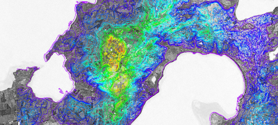
The Danish Elevation Model dataset (DHM - Danmarks Højdemodel) holds records of the heights in the Danish landscape with reference to ocean as its basic level. | The Danish Elevation Model dataset (DHM - Danmarks Højdemodel) holds records of the heights in the Danish landscape with reference to ocean as its basic level. | ||
| − | The | + | The Danish Elevation Model data is available in WindPRO in different four different verions: one based on gridded raw data sources and three based on raw vector data sources. The data sources are: |
| + | |||
| + | * DHM 10m gridded data | ||
| + | * DHM 2.5m contour lines | ||
| + | * DHM 5.0m contour lines | ||
| + | * DHM 10.0m contour lines | ||
| + | |||
| + | Please note, that the dataset was updated early 2013. | ||
== Coverage == | == Coverage == | ||
Revision as of 21:47, 23 May 2013
Introduction
The Danish Elevation Model dataset (DHM - Danmarks Højdemodel) holds records of the heights in the Danish landscape with reference to ocean as its basic level.
The Danish Elevation Model data is available in WindPRO in different four different verions: one based on gridded raw data sources and three based on raw vector data sources. The data sources are:
- DHM 10m gridded data
- DHM 2.5m contour lines
- DHM 5.0m contour lines
- DHM 10.0m contour lines
Please note, that the dataset was updated early 2013.
Coverage
These dataset covers Denmark.
Availability in WindPRO
The data is available from the WindPRO online services.
Licence and Acknowledgement
The data is distributed according to the OS OpenData terms . Please take proper care to add proper atribution in order to acknowledge the source of information. Typically, this is done by adding the following statement to your report-picture or map:
Contains Ordnance Survey data © Crown copyright and database right [year]
Raw Data Types
- Raw vector data is stored in the DXF-format.
- Grid data is stored in either ASCII-Grid or NTF-format.
External Links
- Original data is available from the web-page of the Ordnance Survey http://www.ordnancesurvey.co.uk/oswebsite/products/land-form-panorama/index.html.
- OS OpenData Terms / Licence is available here: http://www.ordnancesurvey.co.uk/oswebsite/docs/licences/os-opendata-licence.pdf.
