Global AW3D30
Introduction
The “ALOS World 3D 30 m mesh (AW3D30) - dataset is recent digital surface model (DSM) with global coverage. The version 2.1 of the dataset was released in early 2018 – and it holds a global coverage in a 30m (1-arc-second) resolution. The dataset was created with the aim for a target vertical accuracy of 5m RMSE – and a horizontal accuracy of 5m. AW3D30 was generated from data obtained from the Panchromatic Remote-sensing Instrument for Stereo Mapping (PRISM). This instrument was carried onboard the Japanese Advanced Land Observing Satellite (ALOS). The ALOS satellite was launched on January 24th 2006; it had an expected target life of 5 years. After a successful mission it ended its operations during May 2011 due to a power anomaly.
Availability from within windPRO
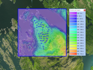
The data is available directly from within windPRO in 1 arc second resolution. The data can be accessed from the online-services in the following objects:
- Line Object (with purpose to height contour lines)
- Elevation Grid Object
Data Type
The DSM Elevation Data is delivered as gridded data with a spatial resolution of 1 arc second. As a part of the processing of the DSM Elevation Data from our EMD server, the user has an option of choosing whether the data downloaded should be received as either raw gridded data or converted to height contour lines. In order to use the data for energy yield calculations, the data must be converted to contours.
The elevation grid is in coordinate system: Geographic WGS (EPSG:4326)
Coverage
The ALOS dataset covers most of land bodies on earth.
External Links
- More information on ALOS DSM project is available at http://www.eorc.jaxa.jp/ALOS/en/about/about_index.htm
- AW3D30 - Product description (pdf-format) - here
