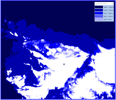
Global Bathymetry GEBCO
Introduction
This dataset is relevant for windPRO users working with offshore wind farm development. The General Bathymetric Chart of the Oceans (GEBCO) is a global bathymetry dataset – developed from multiple sources by an international group of experts. The resolution of the dataset is at 30 arc-seconds (approximately 1km). It was released in 2014 – based on a previous version from 2008. Traditionally, the GEBCO dataset have focused on deep-water areas (i.e. beyond 200m water depth), however with the recent versions many shallow water areas have been added based on contributions from national hydrological offices.
Availability from within WindPRO and Usage Notes
The data is available directly from within windPRO and can be accessed from the online-services in the Elevation Grid Object.
Usage:
- In order to access the data, please set the purpose of the Elevation Grid Object to 'Water depths'.
- If you want to export the grid to contour lines: This can be done from within the grid-object, simply select the layer of interest, then choose 'Export Layer'.
- The original dataset from GEBCO also include land elevations – these originate from the various sources, such as: SRTM30, GMTED2010, IBCAO v3, Bedmap2 and a DEM for Greenland by Ekholm. These are not distributed with windPRO – instead use the higher quality data that comes with the windPRO online services.
- The dataset with windPRO is processed, so that it only holds water depths (with the convention that water depths are with negative values).
Reference System
The following reference system was used in the original data:
- Horizontal: Geographical [deg,min] - WGS84
- Vertical: The GEBCO dataset is generated from multiple sources. However, generally, the vertical co-ordinate can be assumed to be reffered to the mean-sea-level (MSL). At some shallow-water areas – the vertical datum may be other than MSL.
Feedback to GEBCO
Any reported errors in the datasets are available from the errata-page of GEBCO. Users are encuraged to report any problems back to GEBCO <click-here> in order to ensure further future improvements of the data.
Coverage
Global
License and Attribution
Please use the following attribution when using this dataset - and also consider and accept the disclaimer from GEPCO.
The GEBCO_2014 Grid, version 20150318, http://www.gebco.net. Distribution through windPRO and EMD.
Acknowledgement
The international group of experts and GEBCO are thanked for producing this global bathymetry dataset – and disseminating it in the public domain and thus for aiding the development of renewable energy and in particular the offshore based wind-energy.
External Links
- Description of the GEPCO Bathymetry data set: https://www.gebco.net/data_and_products/gridded_bathymetry_data/gebco_30_second_grid/
