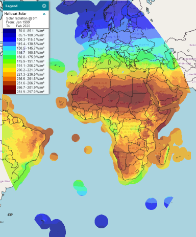
Heliosat Solar
Jump to navigation
Jump to search
Introduction
"Heliosat Solar" is a satelite based surface radiation dataset produced and delivered by CM SAF (Satellite Application Facility on Climate Monitoring). The windPRO dataset is composed of two different datasets, namely:
- Surface Radiation Data Set - Heliosat (SARAH) - Edition 2.1 : This dataset covers the period from 1999-01-01 to 2017-12-31
- ICDR SEVIRI Radiation - based on SARAH-2 methods : This dataset is an operational dataset that covers the period from 2018-01-01 to present
The Validation report of the ICDR dataset concludes that there is a resonable consistency between the two datasets.
Dataset Overview
- Content:: Surface radition parameters to be used in Solar calculations in windPRO
- Spatial Resolution: The dataset is available on a regular geographical (lat/lon) grid at 0.05x0.05 resolution (around 5 km).
- Temporal Resolution: 30 minute values.
- Coverage: The dataset has an extend +- 65 degrees in both latetidues and longitudes. In windPRO, offshore coverage is at a distance of approximately 300 km from any known coastlines.
- Period: 20+ years. The EMD databases will hold data back to 1999.
