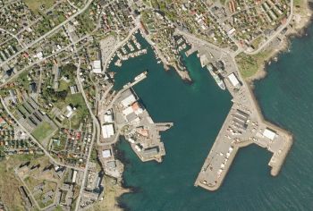
Faroe Islands Orthophotos

Introduction
The Faroe Islands Orthophoto Imagery is a part of the dynamic, zoomable maps in windPRO. The orthophoto-map was released from the Environment Agency in the Faroe Islands as parts of its portals "føroyakort" (https://www.foroyakort.fo) and "kortal" (https://www.kortal.fo). The data are provided 'as-is' and via a national, open data license. Orthophotos are available in resolutions between 0.2m and 0.5m for different parts of the islands. For windPRO integration, these have been resampled into a pixel resolution of 0.5m.
Usage Notes
- The mosaic was created from available data sources accessed in June 2023
- Some clouds are visible for smaller parts of the islands
Availability from within windPRO
- From map window: Click the ‘Add map’ globe-icon -> then ‘Dynamic Maps’.
- From main menu: Click ‘Project’ -> ‘Properties’ -> ‘Background Maps’ -> ‘Dynamic Maps’
License and Attribution
Source and usage conditions: Contains data from the Faroese Environment Agency, Umhvørvisstovan: Orthophotos, myndakort - fjarmyndir (downloaded 2023) - https://www.foroyakort.fo/um-foroyakort/terms-and-conditions-in-english/
Acknowledgement
- The Faroese Environment Agency, Umhvørvisstovan are thanked for releasing this orthophotos dataset – and disseminating it in the public domain and thus for aiding the development of renewable energy.