NASA-DEM
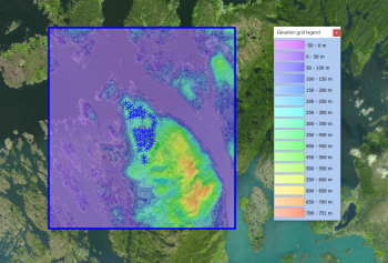
Introduction
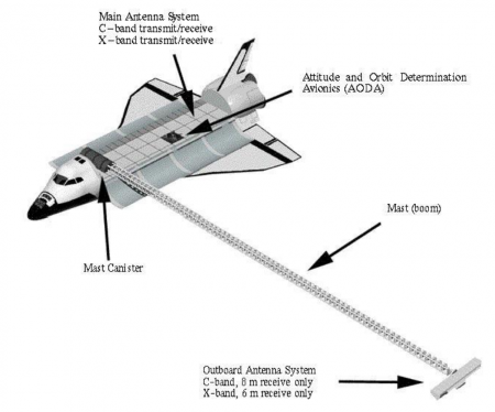
In early 2020, a global elevation model with improved digital elevation data was released by NASA through its NASADEM dataset. NASA has re-visited the telemetry data obtained by the original Shuttle Radar Topography Mission (SRTM). This data was obtained by the space shuttle Endeavour during the STS-99 mission that flew 11 days during February 2000. This original telemetry data has been re-processed with improved algorithms and any missing (void) areas have been patched with better data sources, such as ASTER, ICEsat and national models. The result is a much improved dataset over the original SRTM dataset and at 1 arc-second resolution. A quality mask is available so the source of data is easily determined. Coverage is all land masses between 60N and 65S — this corresponds to 80% of the Earths land mass. This dataset was produced by NASA - the National Aeronautics and Space Administration of the United States of America.
Dataset Overview
- Spatial Coverage: Near global - coverage is most of land bodies on earth between degrees 60N and 65S (see our SRTM page, here).
- Resolution: 1 arc-second (approximately 30m)
- Data-type: Digital Surface Model (DSM)
- Coordinate system (horizontal): Geographic WGS (EPSG:4326)
- Coordinate system (vertical): EGM96 geoid
- Version: WindPRO holds the 1.0 version of the NASADEM data
- Vertical Accuracy: See below - section 'Accuracy of NASADEM'.
Recommendations
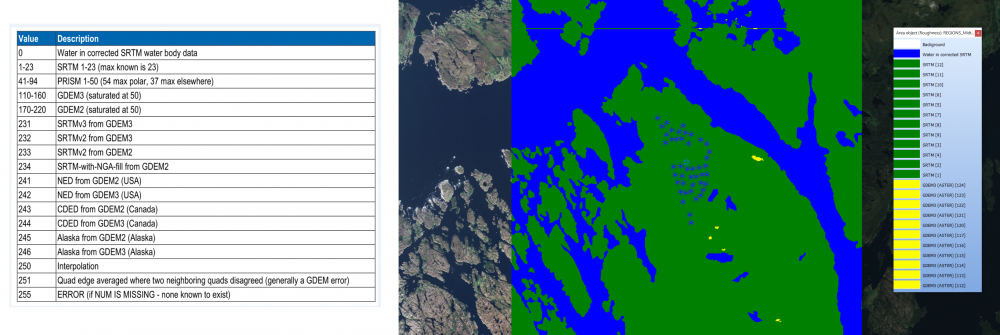
The release of the NASADEM dataset is very exciting as many wind farm projects are built in locations without access to high quality national elevation models. As such we still rely and trust the SRTM 1-arc-second data - at least during the initial prospecting phase. The NASADEM offers the same spatial resolution as the original SRTM 1 arc-second dataset (with 30m grid resolution), but also an opportunity for improved quality through improved algorithms and better data for void-filling. An additional benefit is the possibility to evaluate the data quality: This is done through the quality-mask layer: Here the origin of the data-source and the number of shuttle-passes are fully transparent. It is highly recommended to inspect the NASADEM quality mask before actually applying the data in your analysis:
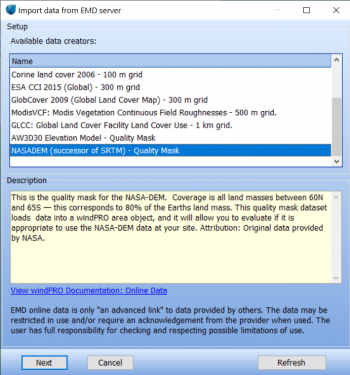
The NASADEM quality mask is available from within the windPRO area object, and we recommend that you inspect it in the following way (look for void-filled areas and also to see how many times the shuttle passed the area of interest):
1. Open your windPRO project and create a new area-object
2. Set purpose to 'Roughness map based on closed lines'
3. Click the 'Online data' button
4. Choose the 'NASADEM (successor of SRTM) - Quality Mask'.
5. Click 'OK' to load. Please be patient: It may take some minutes to load and process the data.
6. Go to the 'Presentation' tab - and set checkmark in 'Transparent' for the 'Boundary Line' - then press 'OK'
7. Right-click the area-object icon - remove the 'edit-mode' and choose to 'Show legend'
Availability from within windPRO
The DSM-data and the associated quality mask are available directly from within windPRO. The DSM elevation data is delivered as gridded data with a spatial resolution of 1 arc second. As a part of the processing of the DSM elevation data from our EMD server, the user has an option of choosing whether the data downloaded should be received as either raw gridded data or converted to height contour lines. In order to use the data for energy yield calculations, the data must be converted to contours. These data be accessed from the online-services in the following three objects:
- DSM-Data in the line object (with purpose to height contour lines)
- DSM-Data in the elevation grid object
- Quality mask from NASADEM is accessed from the area-object
Accuracy of NASADEM
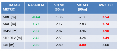
The accuracy of NASADEM has been investigated by EMD. This was done using ground truth data (high-quality local DEM's) from 1608 wind turbine locations in 12 countries around the globe. An overview of the main metrics from the investigation is shown in the table. The following abbreviations are used: MBE = Mean Bias Error; MAE = Mean Absolute Error, RMSE = Root Mean Square Error, STD.DEV. = Standard Deviation and IQR = Inter Quantile Range.
As shown in the table, the NASADEM model performs better than the alternatives for all considered metrics.
Acknowledgement
NASA, team around STS-99 and the US public are thanked for making this great digital elevation dataset available in the public domain and thus for aiding the development of renewable energy.
License
NASADEM data is released in the public domain and may be used without restriction for any purpose whatsoever. At EMD we recommend to use the following statement when using these data:
Acknowledgement: Contains NASADEM elevation data. Courtesy NASA/JPL-Caltech.
Data processing and distribution through EMD and windPRO.
Links and More Documentation
