Spanish Orthophoto Mosaic
Jump to navigation
Jump to search

Introduction
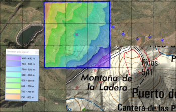
The Spanish Orthophoto Mosaic is a part of the dynamic, zoomable maps in windPRO. The orthophotos were released by the National Geographic Institute of Spain (Instituto Geográfico Nacional, IGN). Pixel size for the dynamic map in windPRO is 1m.
Usage Notes
- The mosaic was created from available data sources accessed in Match 2019
- The most recent imagery is used to create the mosaic
Availability from within windPRO
- From map window: Click the ‘Add map’ globe-icon -> then ‘Dynamic Maps’.
- From main menu: Click ‘Project’ -> ‘Properties’ -> ‘Background Maps’ -> ‘Dynamic Maps’
License and Attribution
Contains data from the National Geographic Institute of Spain (Instituto Geográfico Nacional, IGN).
Acknowledgement
- The National Geographic Institute of Spain (Instituto Geográfico Nacional, IGN) are thanked for producing this digital dataset – and disseminating it in the public domain and thus for aiding the development of renewable energy.
- Integration of this dataset into EMD services was co-supported through the InnoWind project ([http://www.innowind.dk www.innowind.dk) which is co-funded by the Danish Innovation Fund