RASP Sweden: Difference between revisions
Jump to navigation
Jump to search
No edit summary |
|||
| Line 1: | Line 1: | ||
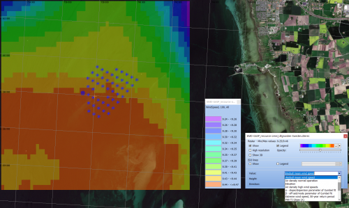
[[Image:GASP_WindResources_WindPRO.png|thumb|right|500px|Wind Resouces in 100m height at Lillgrunden, Sweden. GASP data accessed through windPRO 3.5.]] | |||
== Introduction == | == Introduction == | ||
"RASP Sweden" is short for "Regional Atlas of Siting Parameters for Sweden". It is a calibrated regional wind atlas dataset with the following key features: | "RASP Sweden" is short for "Regional Atlas of Siting Parameters for Sweden". It is a calibrated regional wind atlas dataset with the following key features: | ||
Revision as of 22:21, 14 June 2021

Introduction
"RASP Sweden" is short for "Regional Atlas of Siting Parameters for Sweden". It is a calibrated regional wind atlas dataset with the following key features:
- Regional Coverage - Sweden
- Calibrated parmeters - with coverage at 250m resolution
- Available parameters are wind resources, siting parameters & turbine design classification
- Builds on DTU GWA (Global Wind Atlas) datasets and EMD's Load Response technology
- Is developed in the GASP project - joint R&D project by EMD and DTU
Dataset Overview
- Spatial coverage:
- Onshore: Swedish National Coverage
- Offshore: Areas are covered up to approximately 50 km from the coastline
- Resolution:
- Horizontal: 250m in grid resolution
- Vertical: 100m and 150m as vertical levels
- Data-type: Atlas
- Coordinate system: Geographical coordinates (EPSG: 4326) in original data
- Version: 0.3 (this dataset is a demonstration dataset, and it is currently in beta release)
Availability from within EMD software
- windPRO: In 'Data' menu click 'Siting parameters (GASP etc)' to access the download tool. Data is loaded into a result layer with a .siteres file acting as the data-container.
- The .siteres file can be used in PARK, Site Compliance, Load Response and Optimization calculations.
- windPROSPECTING: GASP data is available through the data-tab named 'Site-prospecting'. Free access to windPROSPECTING - here.
- windprospecting offers spatial view of omnidirectinal parameters and detailed point-data with directional results and statistics.
- EMD-API: Read more at the dedicated wiki-page for our Global Atlas Data Services - here. If you are accessing the GASP data from within the EMD-API, you will use the parameter group-names in order to request specific data-packages [resource-omni, resource-sector, siting-extremes, siting-fatigue-omni, siting-fatigue-sector, turbine-fatigue, turbine-fatigue-recommend, turbine-extreme, turbine-extreme-recommend].