Difference between revisions of "UK-Great Britain: OS Open Maps"
m (→Data License) |
|||
| Line 1: | Line 1: | ||
| + | [[Category:Online Data]][[Category:Maps]] | ||
OS OpenData is a map service provided by Ordnance Survey. The maps cover Great Britain and a viewer is available here: http://www.ordnancesurvey.co.uk/oswebsite/opendata/viewer/ | OS OpenData is a map service provided by Ordnance Survey. The maps cover Great Britain and a viewer is available here: http://www.ordnancesurvey.co.uk/oswebsite/opendata/viewer/ | ||
Revision as of 13:19, 29 May 2013
OS OpenData is a map service provided by Ordnance Survey. The maps cover Great Britain and a viewer is available here: http://www.ordnancesurvey.co.uk/oswebsite/opendata/viewer/
While the OS OpenData utilizes many different layers such as StreetView, MiniScale and Boundary-Line (Additional information regarding layers: http://www.ordnancesurvey.co.uk/oswebsite/opendata/discover.html) the OS OpenData maps available in WindPRO display the basic maps allowing you to change the scale as desired, unlike some of the mentioned layers.
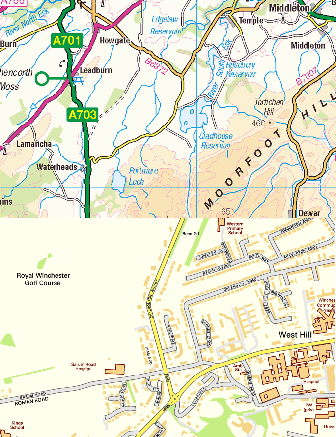
Samples of OS OpenData are displayed in the figure below.
Data License
OS OpenData is licensed under the Open Government License.
Full license details are available here:
http://www.ordnancesurvey.co.uk/oswebsite/docs/licences/os-opendata-licence.pdf
You are free to copy, distribute, transmit and adapt OS OpenData, as long as you credit Ordnance Survey.
Credits
OS OpenData require that you use the credit “© Crown copyright and database rights 2013 Ordnance <year>”.
